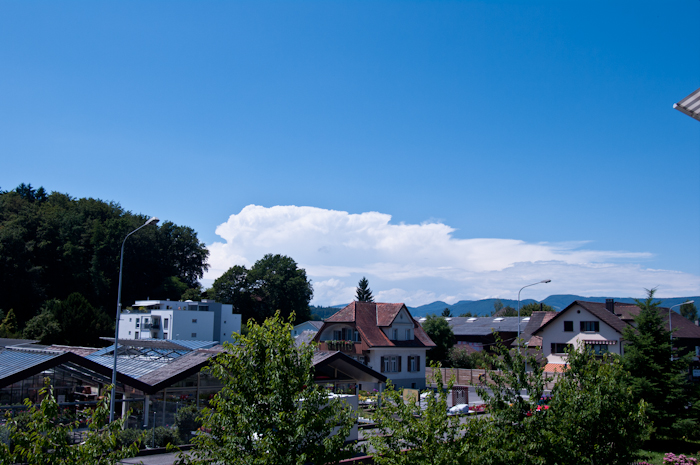
Nach gestern folgt morgen bereits die nächste Lage mit Unwetterpotential. Am Nachmittag heizt es wohl verbreitet auf 27-30°C auf
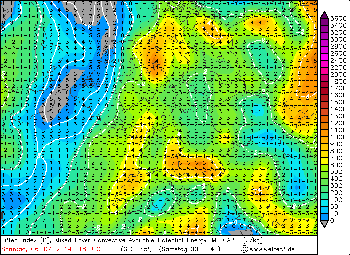
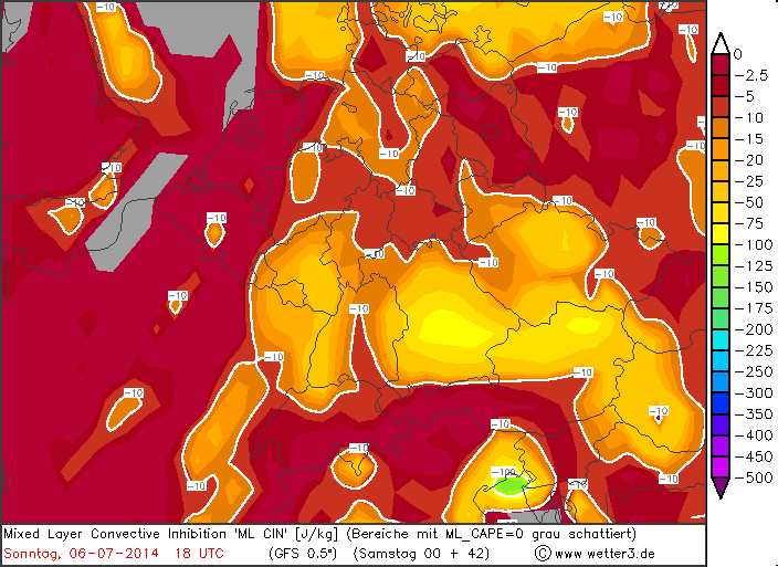
Energie vorhanden, Strömung SW, Deckel geringer.

www.wetter3.de
http://www.wetterzentrale.de
mol luege
In Zusammenarbeit mit meteoradar

Werbung
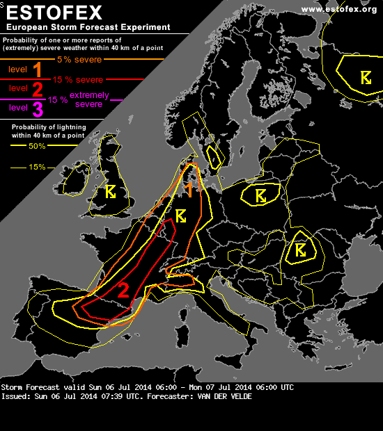
Quelle: www.estofex.orgDISCUSSION
...central France to Netherlands and Germany...
The capping will be weak, but insolation seems to be limited by the broken cloud cover from western France to Netherlands already, so initiation may be questionable there, and GFS model indicates a zone with poor mid level lapse rates in the late morning. On the other hand, a maximum of low/mid level winds and strong low-level shear passes that area in the late morning. Chances for tornadoes and severe gusts would be enhanced, but the confidence is quite low that storms develop in that corner. This may instead happen further to the east in the afternoon. Still the CAPE should be better to the south (eastern France) and also a patch of subsiding motion in mid levels may cross Benelux.
Further to the east and south, there are no strong and well-defined convergence zones found in the GFS model. This may be a good thing in that a dragging mess of convective debris in the only initiation zone may not develop, which allows a number of discrete storms to form over a wider weakly capped region helped by some orographic lifting. However, problematic may become the system that has already developed over southern France and is on its way to northeastern France with extensive cloud cover. Behind it, conditions will likely recover as a sufficiently long period of sun will be available. Ahead of it, too little warming may limit the severe weather potential.
Vertical shear will be sufficent, in principle, for supercells (15 m/s to over 20 m/s) with only slightly enhanced SREH for both left and rightmoving cells. In fact this illustrates a delicate balance between warm air and cold air advection, with the latter environment losing instability. Over northeastern France and northward, low-level shear dominates (10-15 m/s at 12Z, then decreasing). So the threat can be summarized as large hail from supercells, mainly those further to the east where cloud bases can remain higher (including isolated cases in SW Germany), and tornado/bow echo severe gust chances especially from northern France, Belgium, eastern Netherlands and western Germany. Although the limited CAPE and evolution of the early morning convection reduce the confidence in widespread severe weather, a marginal level 2 is issued.
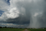
At the west side of the Alps storms may stick along the cold front during the night with some potential for local excessive convective rain.

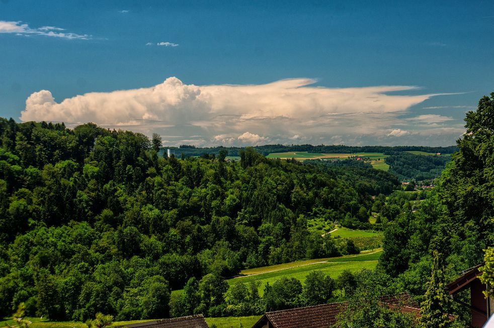
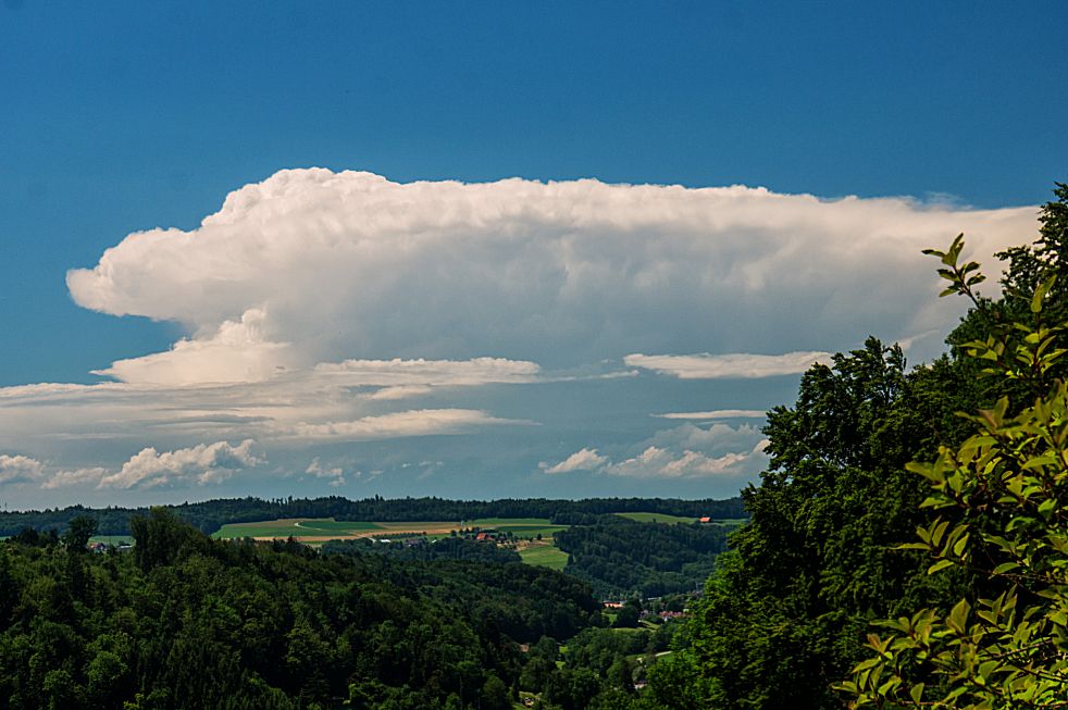
Das einzige Gewitter über der ganzen Schweiz bisher:Microwave hat geschrieben:Am Jura hat's bereits gezündet...rd. 2h zu früh^^
Grüsse - Microwave


Werbung