Danke Andreas
Estofex setzt die gesamte Schweiz unter Level 1
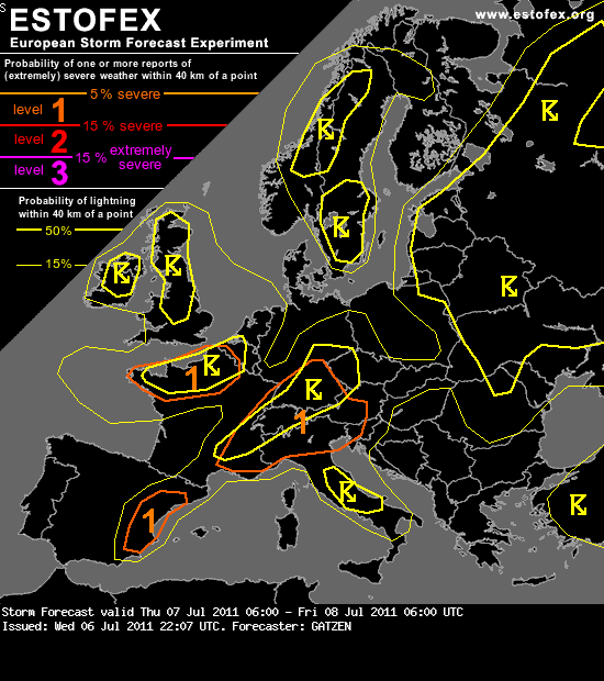
Storm Forecast
Valid: Thu 07 Jul 2011 06:00 to Fri 08 Jul 2011 06:00 UTC
Issued: Wed 06 Jul 2011 22:07
Forecaster: GATZEN
A level 1 was issued for the northern Alpine region mainly for severe wind gusts and excessive rain.
A level 1 was issued for south-eastern France and Switzerland mainly for severe wind gusts and excessive rain.
A level 1 was issued for the Alps and northern Italy mainly for large hail and severe wind gusts.
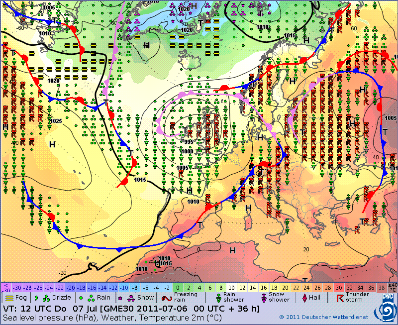
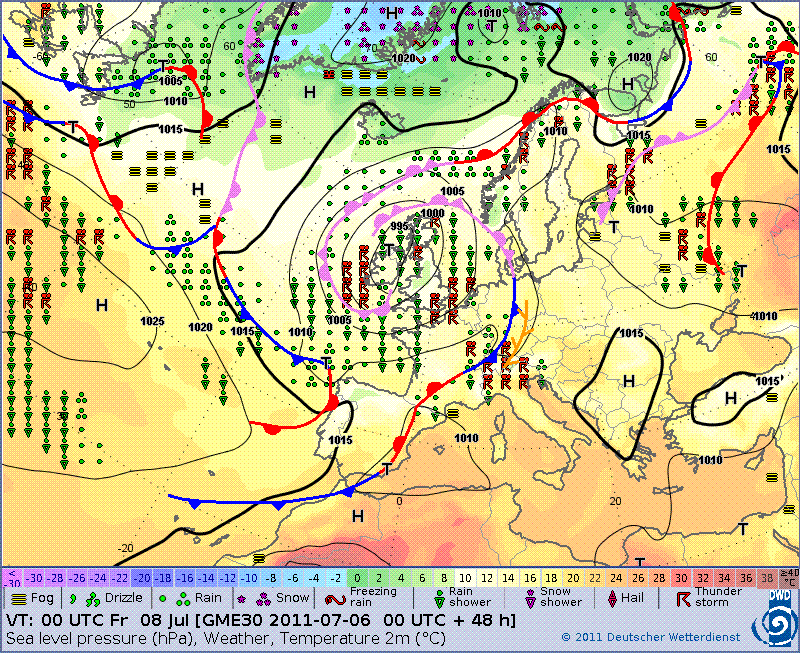
SYNOPSIS
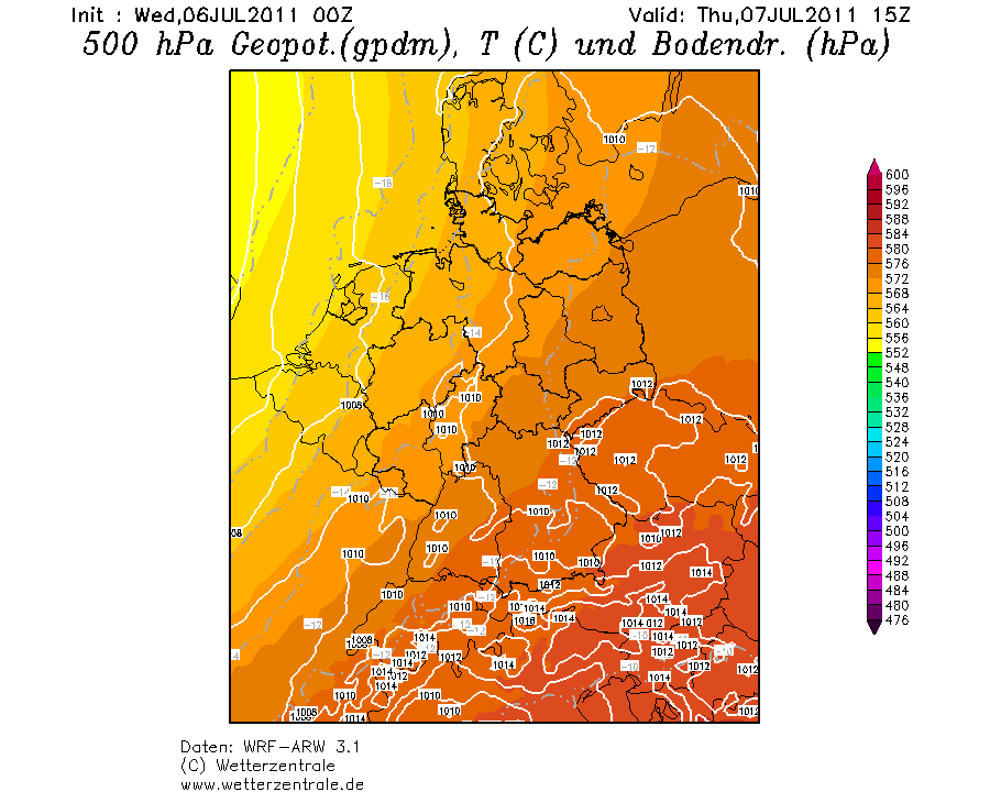
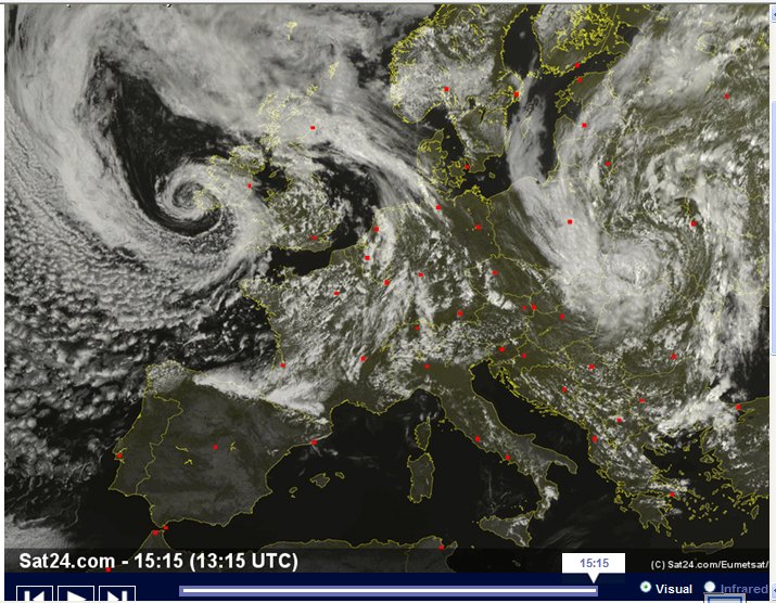
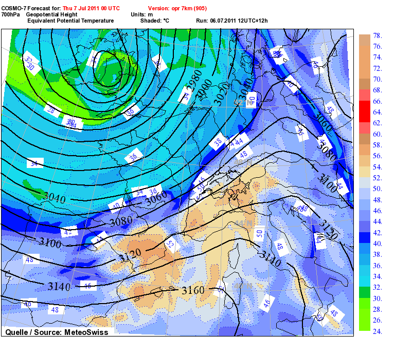
A quasi-stationary trough is centred over the British Isles, another over Belarus. Between these features, a ridge amplifies over Poland. A strong mid-level jet curves around the western trough and affects most of western and northern Europe. At low levels, a frontal boundary extends from northern Spain across France into central Germany on Thursday.
DISCUSSION
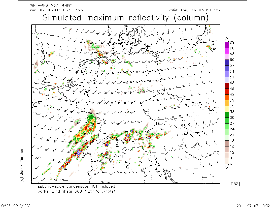
Northern Alpine region
Ahead of the western trough, a tongue of rather steep lapse rates indicated by latest Nimes sounding advects into the Alpine region east of a
cold front. At low levels, easterly winds are forecast to the north of the Alps, where the low-level moisture is expected to increase underneath an
inversion during the day. Thunderstorms are initially expected over the Alps during the noon and afternoon hours. Slightly enhanced deep layer vertical wind shear at the anticyclonically sheared flank of the mid-level is forecast to support some stronger storms, capable of producing large hail and severe wind gusts. Locally, excessive precipitation is not ruled out.
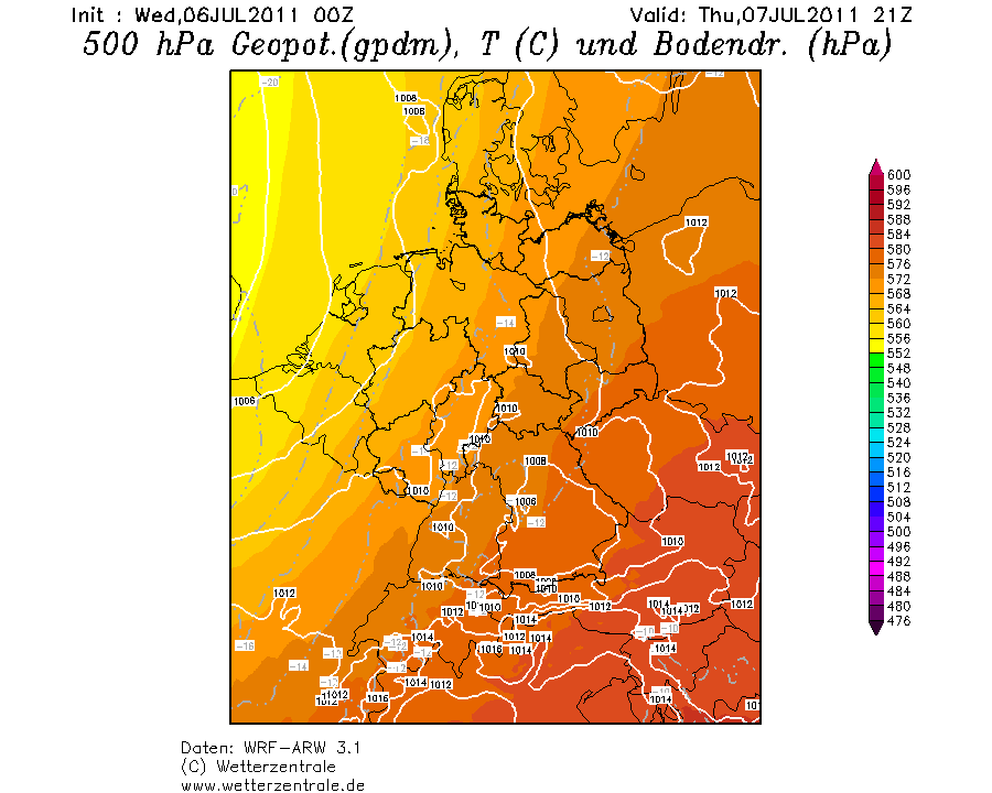
In the afternoon and evening hours, latest GFS model run indicates
a weak short-wave impulse ejecting from the base of the western trough. This will be associated with some QG forcing and increasing thunderstorm activity over the western Alpine region. A
cluster of storms is forecast that may even organize into a bowing line spreading north-eastward or eastward. Rather strong
low-level convergence and moisture will favour this development over most of southern Germany. Strong to severe wind gusts and locally excessive rain are forecast. Additionally, large hail may occur especially near the Alps, where CAPE will be highest.
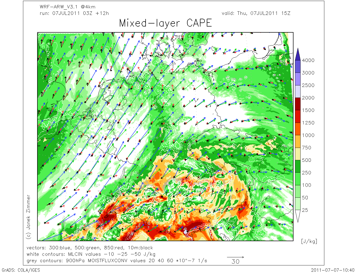
South-eastern France to Switzerland
Latest model output suggests an overlap of moist and unstable air masses along the cold front with increasing vertical wind shear of 20 m/s in the lowest 3 km and 25 m/s in the lowest 6 km. However, it seems that westerly surface winds will spread into Switzerland rather quickly, leading to unfavourably thermodynamic profiles. The best veering is expected over south-eastern France, where southerly winds will remain in the afternoon hours ahead of the cold front.
Current thinking is that most convection will initiate in the afternoon hours, when westerly surface winds will limit the organization. Clusters of storms are expected to spread north-eastward, posing a marginal threat of excessive rain and severe wind gusts. Tornadoes are not completely ruled out and may occur at the leading gust front, where 0-3km SRH could reach values of 200 m²/s² according to the latest GFS.
http://www.estofex.org/
Gruss Cyrill
Edit:
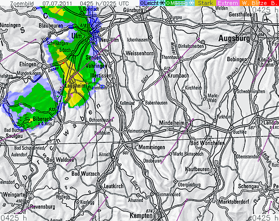
Bei Ulm nun die erste kurz blitzaktive Zelle..