Werbung

Hurrikan GUSTAV

Alles zu (Un)wetter, übriges Europa und weltweit
Benutzeravatar
Kaiko (Döttingen)
Moderator
Beiträge: 2547
Registriert: Sa 1. Sep 2001, 16:23
Geschlecht: männlich
Wohnort: 5312 Döttingen
Hat sich bedankt: 1760 Mal
Danksagung erhalten: 1803 Mal
Kontaktdaten:

Hurrikan Gustav

Beitrag von Kaiko (Döttingen) »

Und das wäre etwa die Zugbahn des Auges über Kuba:

Bild

Da gibt es noch eine Hügelkette zu überwinden, maximal ca. 450m Höhe, aber das beeindruckt Gustav kaum.

Gruss Kaiko
Mitbetreiber des Sturmarchivs Schweiz und Wetterforscher aus Leidenschaft: http://www.sturmarchiv.ch/

221057Gino
Beiträge: 2225
Registriert: Di 1. Jan 2008, 02:49
Geschlecht: männlich
Wohnort: CH 6044 Udligenswil LU
Hat sich bedankt: 2 Mal
Danksagung erhalten: 26 Mal
Kontaktdaten:

Hurrikan Gustav

Beitrag von 221057Gino »

Und das wäre etwa die Zugbahn des Auges über Kuba
=
@Kaiko ( Hallo )

Die Zugbahn von Gustav's Auge über Kuba ( Via Google Earth in 3D ) in verschiedenen perspectives ...

Bild

Bild

Bild

Bild

Bild

Bild


Benutzeravatar
HB-EDY
Beiträge: 933
Registriert: Sa 27. Jan 2007, 15:22
Geschlecht: männlich
Wohnort: 8607 Seegräben/570m
Hat sich bedankt: 171 Mal
Danksagung erhalten: 17 Mal
Kontaktdaten:

Hurrikan Gustav

Beitrag von HB-EDY »

...und das Auge über Kuba....


Bild

und das könnte ins Auge gehen....! :(

salve
Edy
I like stormy nights...................!

Wetterstation Seegräben 570m
http://www.kaikowetter.ch/mc/meteoplug_seegrabenX.html

221057Gino
Beiträge: 2225
Registriert: Di 1. Jan 2008, 02:49
Geschlecht: männlich
Wohnort: CH 6044 Udligenswil LU
Hat sich bedankt: 2 Mal
Danksagung erhalten: 26 Mal
Kontaktdaten:

Hurrikan Gustav

Beitrag von 221057Gino »

Das kann ja heiter werden im Gulf of Mexico.

Wasser Temperatur 30° C

Gustav auch wenn nur kurz könnte die Category 5 erreichen.

Bild

Bild

Bild


- Editiert von 19Gino57 am 31.08.2008, 01:30 -

Benutzeravatar
HB-EDY
Beiträge: 933
Registriert: Sa 27. Jan 2007, 15:22
Geschlecht: männlich
Wohnort: 8607 Seegräben/570m
Hat sich bedankt: 171 Mal
Danksagung erhalten: 17 Mal
Kontaktdaten:

Hurrikan Gustav

Beitrag von HB-EDY »

...und das meint Ibis....

http://www.ibiseye.com/

und es ist und geht was.... :(

salve
Edy
I like stormy nights...................!

Wetterstation Seegräben 570m
http://www.kaikowetter.ch/mc/meteoplug_seegrabenX.html

221057Gino
Beiträge: 2225
Registriert: Di 1. Jan 2008, 02:49
Geschlecht: männlich
Wohnort: CH 6044 Udligenswil LU
Hat sich bedankt: 2 Mal
Danksagung erhalten: 26 Mal
Kontaktdaten:

Hurrikan Gustav

Beitrag von 221057Gino »

@Edy ( Salve )

Gut gewählt Edy. Ein sehr guter Link das von IBISEYE ...
Habe ihn auch schon seit ein paar Jahren. Sehr genau.
=
Radar: Storm Predator ( Trial ) ... Immer die guten Dinge sind Trial

Bild
=
Marine Weather ... Wave High ( Gulf of Mexico ) ...

Bild


- Editiert von 19Gino57 am 31.08.2008, 03:06 -

Severestorms
Administrator
Beiträge: 6637
Registriert: Mo 20. Aug 2001, 17:21
Geschlecht: männlich
Wohnort: Zürich
Hat sich bedankt: 3736 Mal
Danksagung erhalten: 1620 Mal
Kontaktdaten:

Hurrikan Gustav

Beitrag von Severestorms »

Ohalätz!!

CNN-Newsmeldung von eben:

-- Mayor Ray Nagin orders New Orleans evacuated, calling Hurricane Gustav "the mother of all storms."

Ein bisschen übertrieben, jetzt schon von der Mutter aller Stürme zu sprechen, findet ihr nicht?
Founder, Owner and Operator of SSWD - Engaged in Science & Research since 1997.
Follow @SturmarchivCH on Twitter to get accurate information about severe, extreme or unusual weather events in Switzerland - fast and reliable.


Stefan Hörmann
Beiträge: 814
Registriert: Mi 18. Jun 2003, 13:45
Geschlecht: männlich
Wohnort: Ehingen
Danksagung erhalten: 2 Mal
Kontaktdaten:

Hurrikan Gustav

Beitrag von Stefan Hörmann »

Original von Christian Matthys
Ohalätz!!

CNN-Newsmeldung von eben:

-- Mayor Ray Nagin orders New Orleans evacuated, calling Hurricane Gustav "the mother of all storms."

Ein bisschen übertrieben, jetzt schon von der Mutter aller Stürme zu sprechen, findet ihr nicht?
Hallo,

man wird sehen, aber als oberer CAT4 könnte er schon an Land gehen. In der Zugrichtung, in der Gustav nun unterwegs ist, läuft er über oberflächennahes "heißes" Wasser mit knapp über 30°C sowie einer 26°C-Isotherme die bis in 1m Tiefe reicht. Katrina seinerzeit (genau 3 Jahre her) hatte aber eine andere Zugbahn und puschte erst kurz vor Landgang. Gustav jetzt war bereits lange Zeit über heißem Wasser unterwegs und geht jetzt über den karibischen Strom der in den Golf führt, knapp 30 Grad warm.


Schon ein Wahnsinn... und was Hanna noch veranstaltet, das weiß man au no net so gnau.Bild
Viele Grüße,
Stefan, Ehingen/Donau, 545NN, Südrand Schwäbische Alb
http://www.gleitsegelwetter.de - Ein Dienst im Auftrag der Piloten

Mein größter Wetterwunsch zu Lebzeiten: Eine komplette Seegfrörne am Bodensee

Severestorms
Administrator
Beiträge: 6637
Registriert: Mo 20. Aug 2001, 17:21
Geschlecht: männlich
Wohnort: Zürich
Hat sich bedankt: 3736 Mal
Danksagung erhalten: 1620 Mal
Kontaktdaten:

Hurrikan Gustav

Beitrag von Severestorms »

NEW ORLEANS, Louisiana (CNN) -- New Orleans Mayor Ray Nagin ordered a mandatory evacuation of the city beginning 8 a.m. Sunday but urged residents to consider escaping "the mother of all storms" before then.

"You need to be scared," Nagin said of the Category 4 hurricane tearing along Cuba's western coast. "You need to be concerned, and you need to get your butts moving out of New Orleans right now. This is the storm of the century."

The city's west bank is to evacuate at 8 a.m. and the west bank at noon.

Nagin said the city had evacuated roughly 10,000 people Saturday on buses, trains and planes. Buses from collection points would continue running until midnight and resume at 6 a.m. Sunday, he said.

"This storm is so powerful and growing more powerful every day," Nagin said. "I'm not sure we've seen anything like this."

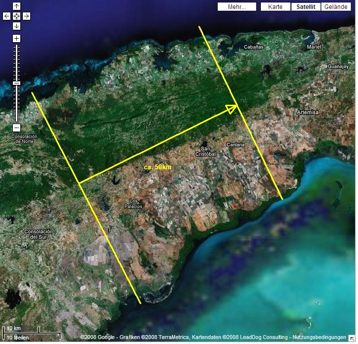
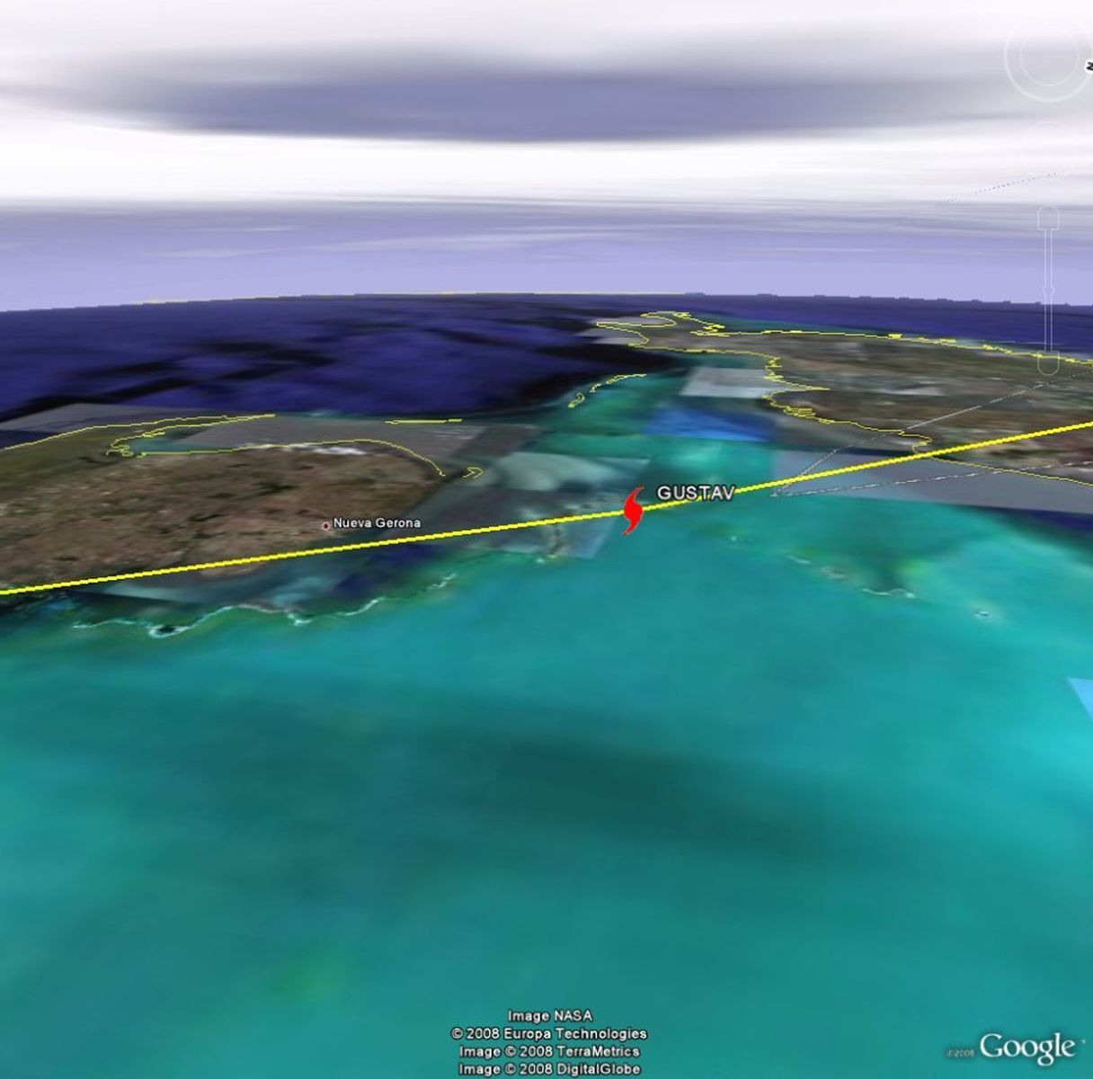
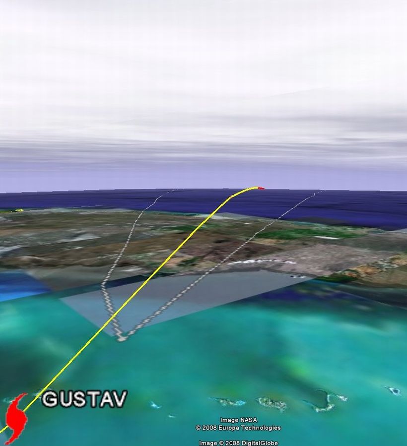
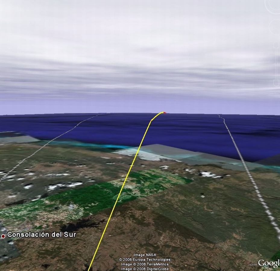
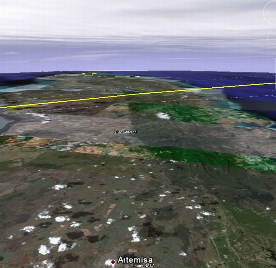
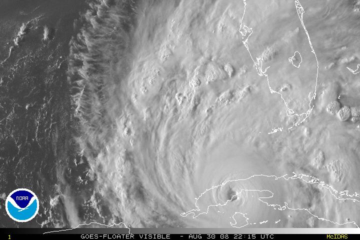
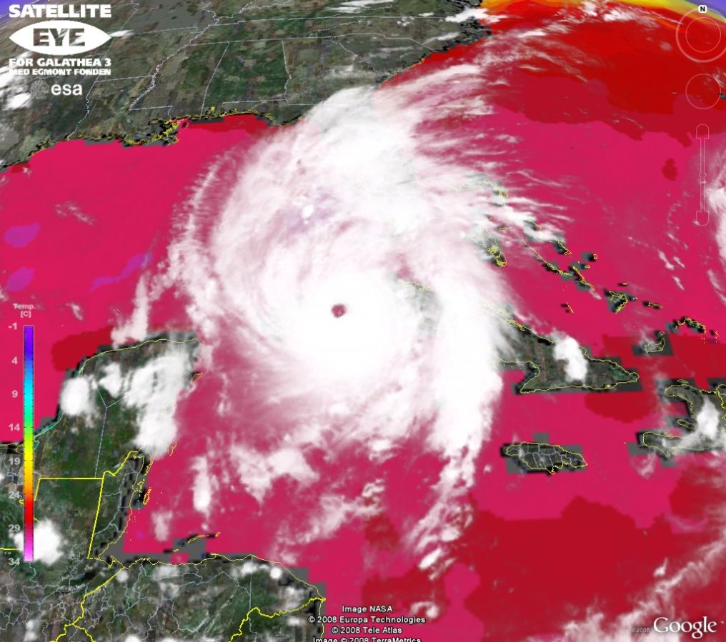
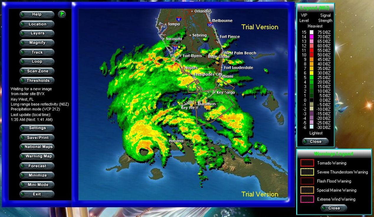
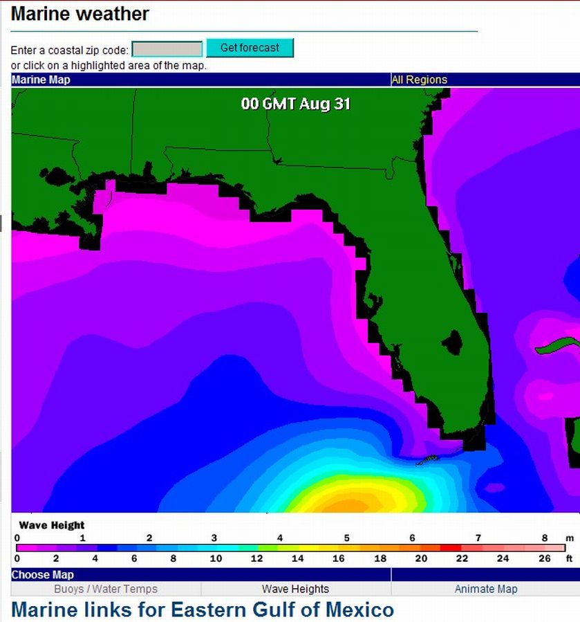
At 8 p.m. ET, Gustav's eye was over western Cuba near Los Palacios, about 65 miles (105 kilometers) west-southwest of Havana, with sustained winds near 150 mph.

Authorities began ordering mandatory evacuations along Louisiana and Mississippi's Gulf Coast earlier Saturday as Gustav roared past Cuba and into the Gulf of Mexico.

"This storm could be as bad as it gets," Louisiana Gov. Bobby Jindal said Saturday afternoon. "We could see flooding even worse than we saw in Hurricane Katrina."

Thousands of people had begun fleeing the coast by the time a hurricane watch was issued Saturday afternoon for southeastern Texas to the Alabama-Florida border as Gustav pursued a projected path toward the U.S. Gulf Coast.

Hurricanes are ranked 1 to 5 in intensity on the Saffir-Simpson scale. A Category 4 has winds of 131 to 155 mph and can cause extreme damage.

Hundreds of people lined up for buses and trains to take them out of New Orleans and thousands of other Gulf Coast residents drove inland, clogging major highways.

Jindal said the state planned to begin "contraflow" procedures, opening both sides of interstates to outgoing traffic only, at 4 a.m. Sunday.

More than a dozen parishes in Louisiana have declared states of emergency, and several others called for mandatory evacuations to begin Saturday and Sunday.

In Louisiana's St. Bernard Parish, where mandatory evacuations began 4 p.m. Saturday, authorities called the order "a matter of survival."

Many parishes also were imposing tough dusk-to-dawn curfews, hoping to assure residents that they could evacuate without fear of their vacant homes being looted.

Jindal did not order mandatory evacuations at a state level, but he urged residents to take the evacuations seriously.

"I wouldn't worry about whether the evacuation in your parish begins at 4 p.m. today or 8 a.m. tomorrow," he said. "When it comes to evacuation, do it sooner rather than later."

In New Orleans, anxiety was high Saturday as residents fled, leaving behind a ghost town of boarded-up homes and empty streets.

At the Union Passenger Terminal in downtown New Orleans, people began arriving as early as 5:30 a.m., forming a line that snaked behind the main Amtrak terminal. Humvees circled the crowds of people, many who waited as long as 2½ hours, enduring the heat and relentless sun, unsure of their destination.

New Orleans officials designated 17 sites for people without transportation to board buses to take them to the terminal, where they will be moved to shelters outside New Orleans. However, scores of residents went directly to the terminal, prompting confusion, as did a glitch in the computer system being used to register people.

Jindal suspended registration at the terminal and instructed people to register when they arrive at shelters. By Saturday afternoon, 1,100 to 1,200 people had left the city on those buses, Nagin said.

"I'm not sure where I'm going," Margie Hawkins of New Orleans said. "My last 24 hours have been somewhat worrisome and very, very prayerful, because this is a very serious threat, and it's a lot of people to get to safe ground or be safe where they are."

The city also arranged with Amtrak for more than 7,000 seats to evacuate the elderly by train. About 1,500 people left for Memphis, Tennessee, Nagin said.

There were also crowds at New Orleans' Louis Armstrong International Airport, which the city plans to keep open through 6 p.m. CT Sunday. Both Delta Air Lines and AirTran Airways said they planned to continue flights in and out of New Orleans until the airport is closed.

Vehicles jammed Interstate 10 headed west toward Texas. Cars also clogged Interstates 55 and 59 heading north out of eastern Louisiana. Heavy volume was also reported on Interstates 65 and 59 as Mississippi evacuees streamed north.

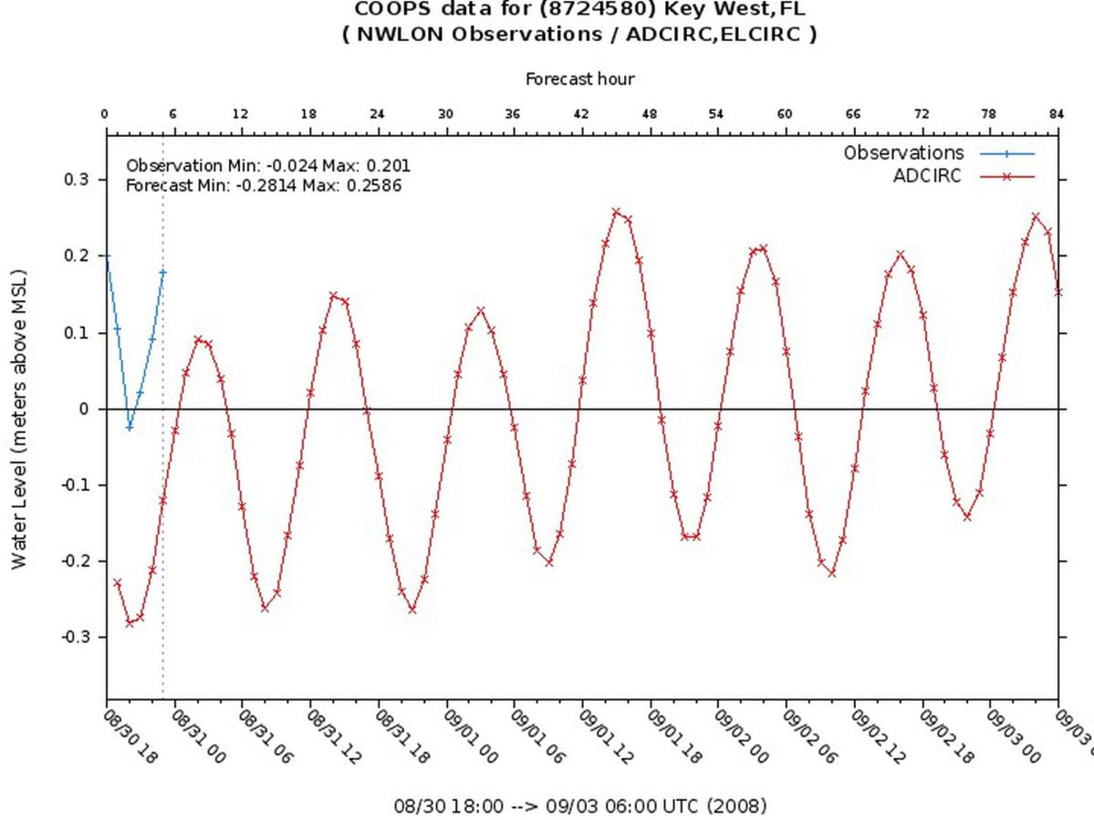
The hurricane is projected to pass over western Cuba and to move into the southern Gulf of Mexico early Sunday and into the central Gulf by early Monday, according to forecasters. Gustav could make landfall as a Category 3 or 4 on the U.S. Gulf Coast late Monday or Tuesday, the National Hurricane Center said.

Quelle: http://edition.cnn.com/2008/US/weather/ ... index.html
Founder, Owner and Operator of SSWD - Engaged in Science & Research since 1997.
Follow @SturmarchivCH on Twitter to get accurate information about severe, extreme or unusual weather events in Switzerland - fast and reliable.

221057Gino
Beiträge: 2225
Registriert: Di 1. Jan 2008, 02:49
Geschlecht: männlich
Wohnort: CH 6044 Udligenswil LU
Hat sich bedankt: 2 Mal
Danksagung erhalten: 26 Mal
Kontaktdaten:

Hurrikan Gustav

Beitrag von 221057Gino »

@Christian M. ( Hallo )

Tja Christian wieso nicht? Gustav wird bald Cat.5 bekommen ... ( Major Hrcne Gustav )

Sobald Gustav ( Major Hrcne Gustav ) Cuba hinter sich hat bekommt er die Cat.5 oder H5 ...
also die Max. Stufe von der Saffir Skala. Er wird mit einer Cat.4 Landfall machen.

Off Topic: Ausserdem möchte ich noch was dazu sagen auf das was ich gepostet habe und so.
Ich finde es einfach unfair das man nicht achtet was man postet und am Schluss dazu kommt
auf das was man gepostet hat ( von anderen Usern ) obwohl ich es seit Tagen angedeutet habe
mit gewisse Modelle aus meiner CD-Software. Aber wird ja überflogen oder übersehen was ich poste.
Das sind ja für Euch Exotische Karten was ich poste und ausserdem gewisse User machen sich noch
Lustig über mich ( Vergrösserung ) so ob ich nicht Lesen kann obwohl ich nur Höflich gefragt habe
aber von Verkleinern ( Rückgängig machen ) oder so keine Spur. Dankeschön!. Sorry! ...

P.S.: Habe es dir hier geschrieben als Off Topic da ich eben eine PM an dich zugesendet habe
aber kam nie eine Antwort!. Dankeschön auch für das. Sorry!

Antworten