Seite 6 von 7
Re: 2009: Tropischer Sturm / Hurrikan BILL
Verfasst: So 23. Aug 2009, 11:45
von URBI
23.08.09
21- 23 45 UTC bis 23- 03 45 UTC
__________

23- 02 45 bis 08 45 UTC
08.45 UTC

+
06.45 bis 10.45 UTC
_____
 09.15 UTC Wolkenfeuchte

+
________________________________________________________________

Re: 2009: Tropischer Sturm / Hurrikan BILL
Verfasst: So 23. Aug 2009, 17:51
von Alfred
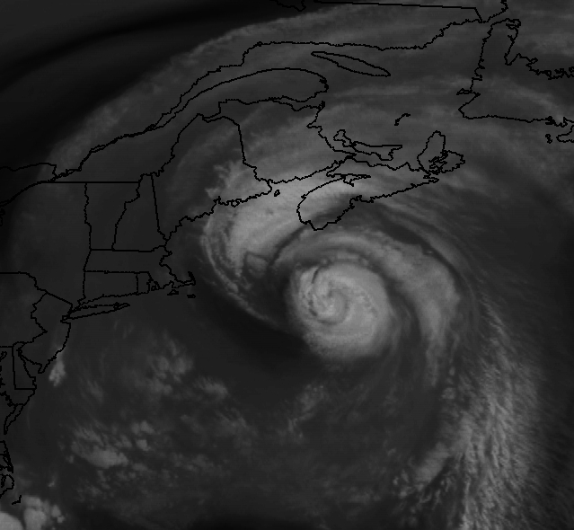
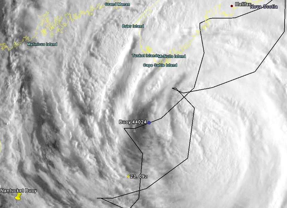
Hoi zäme
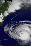
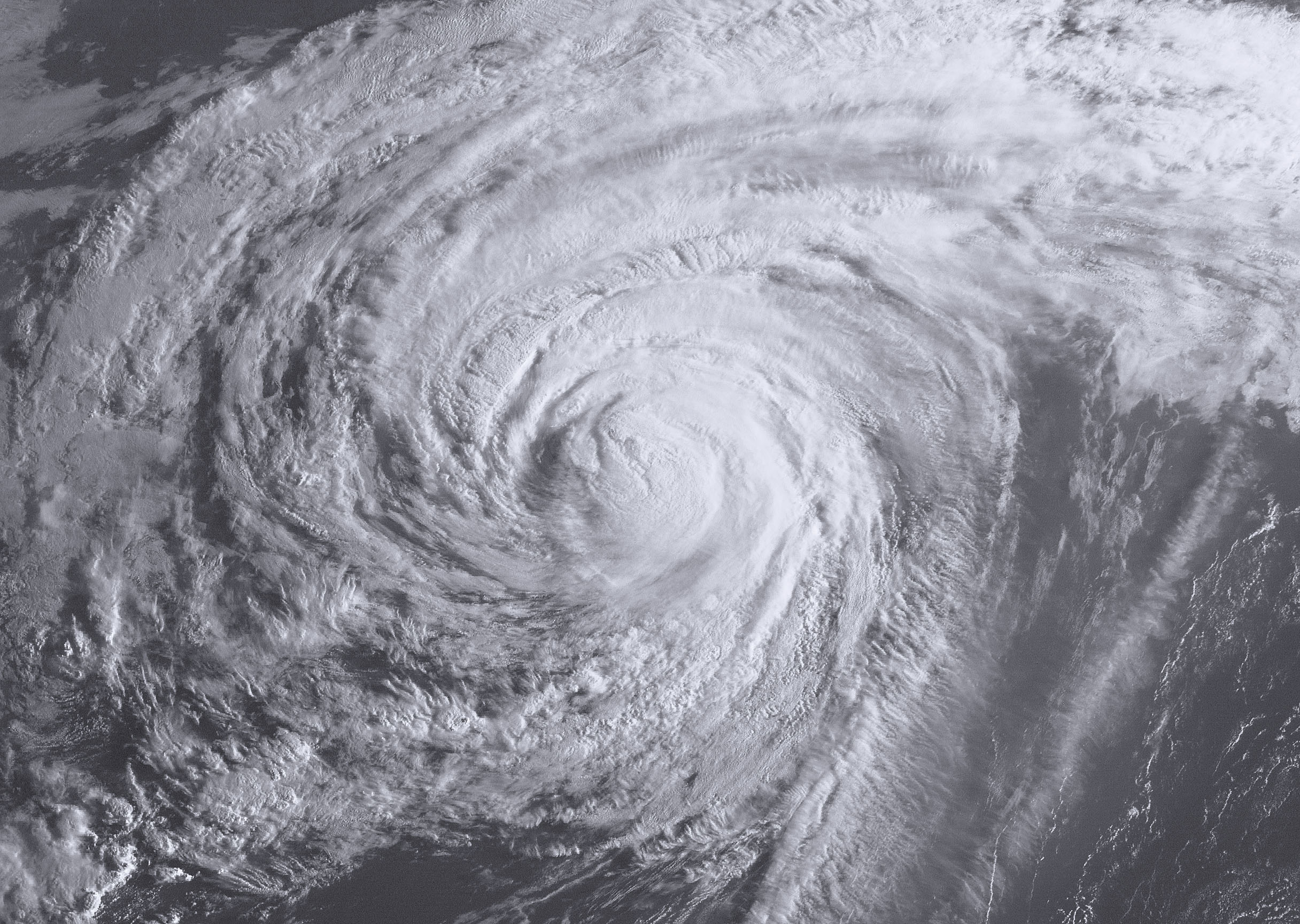
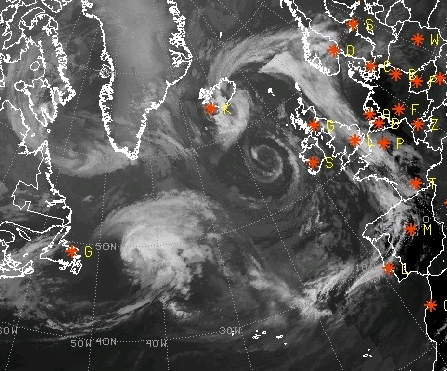
BILL über der Boje 44024 (GOES-11:15 UTC).


Alfred
Das ganze System wie erstes Bild, nur etwas grösser

.

Re: 2009: Tropischer Sturm / Hurrikan BILL
Verfasst: So 23. Aug 2009, 18:46
von Joachim
Hallo
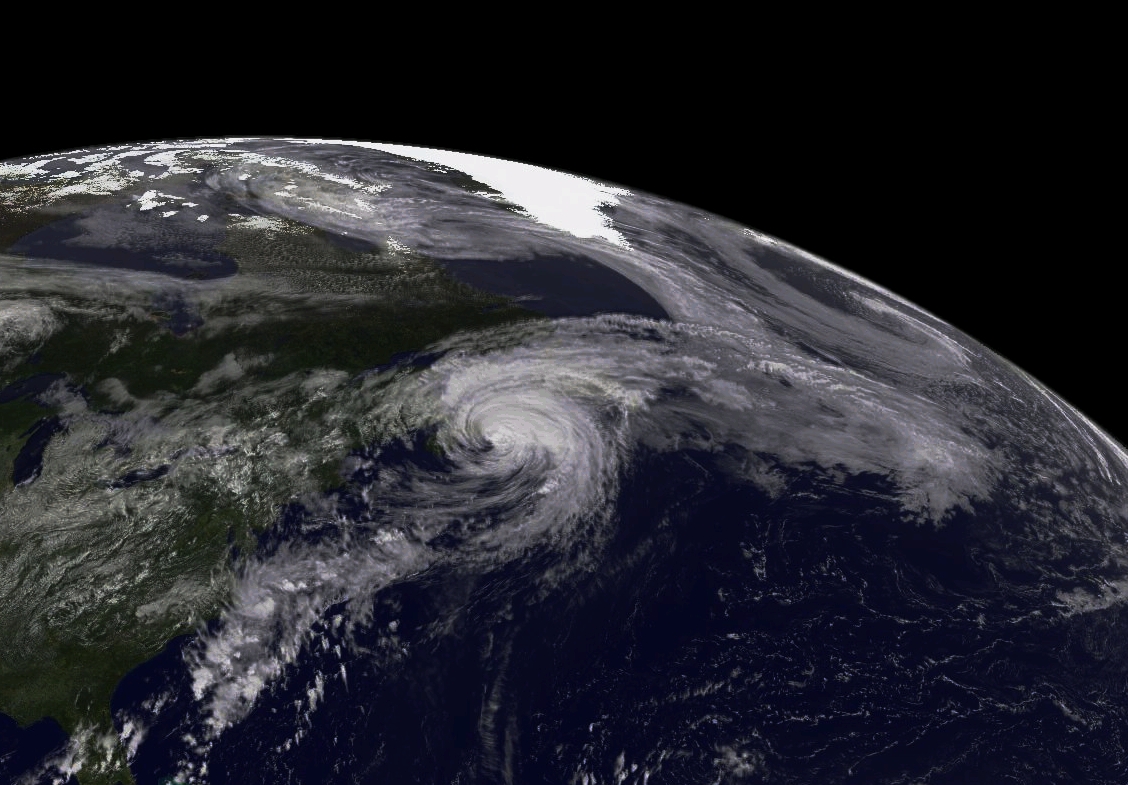
und die Überreste am Mittwochmorgen bei Irland.
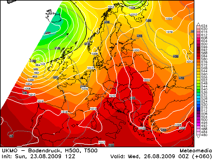
12z Lauf UKMO global model
Joachim
Re: 2009: Tropischer Sturm / Hurrikan BILL
Verfasst: So 23. Aug 2009, 19:57
von Alfred
Off Topic
@URBI, sali
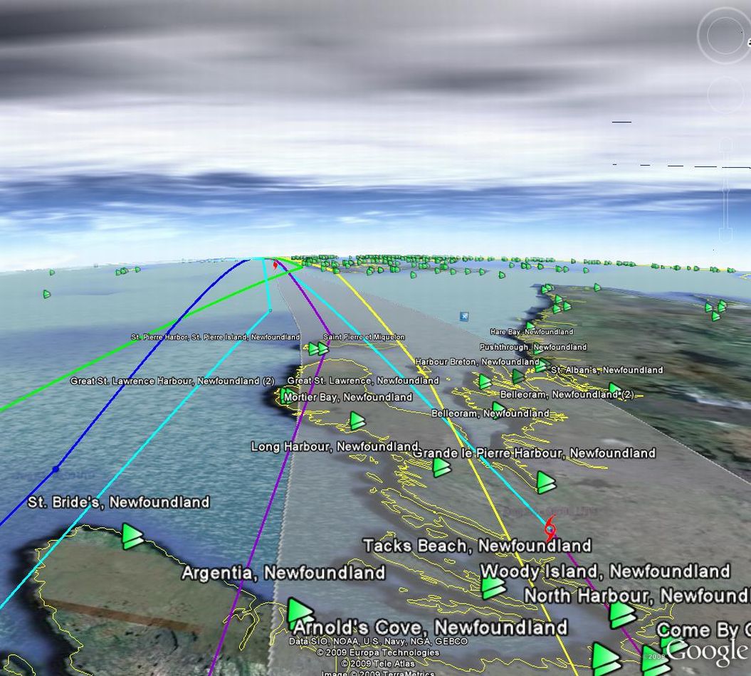
Ich hab noch immer einen Satellitenbilderfriedhof, was das südliche Grönland mit geostationären Satelliten
betrifft. Du scheinst das Problem gelöst zu haben http://www.sturmforum.ch/forum_uploads/ ... I_frei.jpg
Darum meine Bitte an dich, könntest du nicht einige Bilder speichern, wenn das Tief EX-BILL in den Labrador-
strom einfliesst, bis in die Gegend vor Island/Irland?
Gruss, Alfred
Re: 2009: Tropischer Sturm / Hurrikan BILL
Verfasst: So 23. Aug 2009, 22:11
von URBI
Salü @Alfred
Dieses Ist hier abrufbar
http://goes.gsfc.nasa.gov/
Ich werde einige Bilder speichern.
17.45 UTC

+
ANIMATION
05.28.am -bis- 01.47 pm pt
20.45 UTC

+
Grüsse
Urbi
Re: 2009: Tropischer Sturm / Hurrikan BILL
Verfasst: Mo 24. Aug 2009, 00:30
von 221057Gino
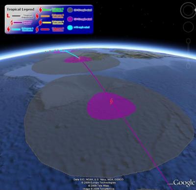
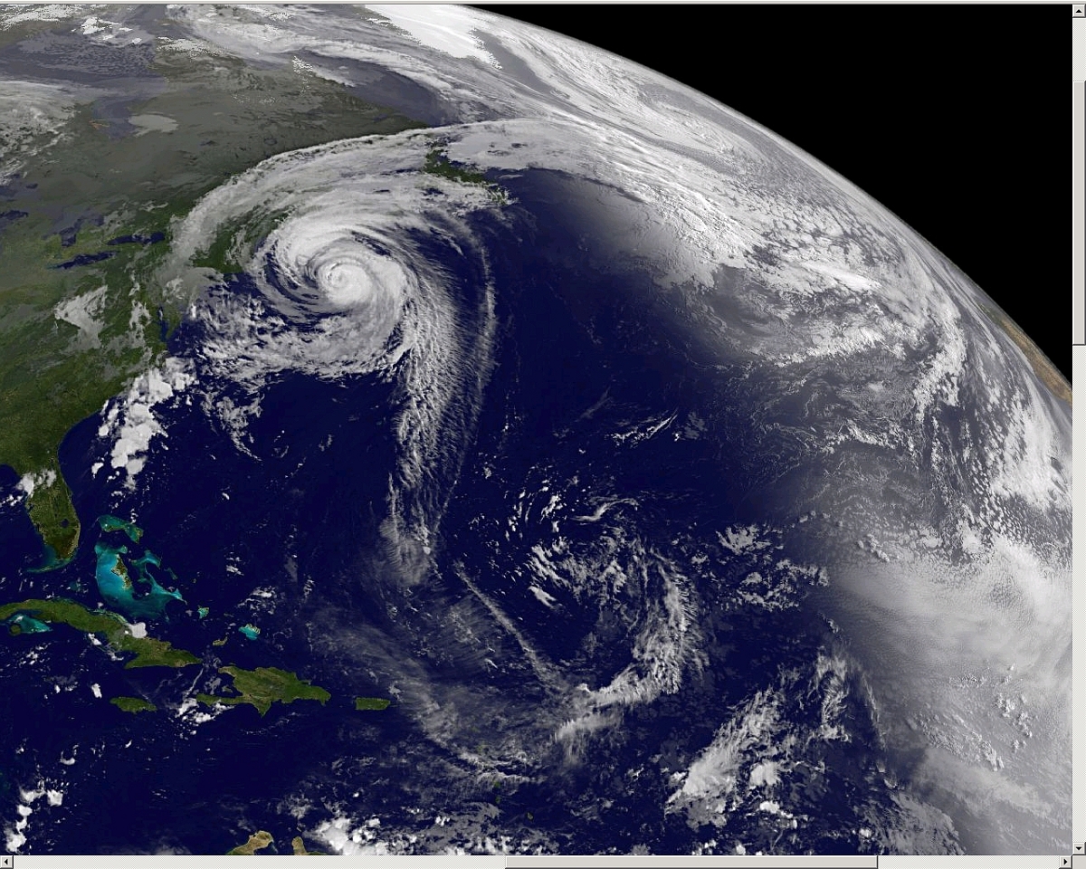
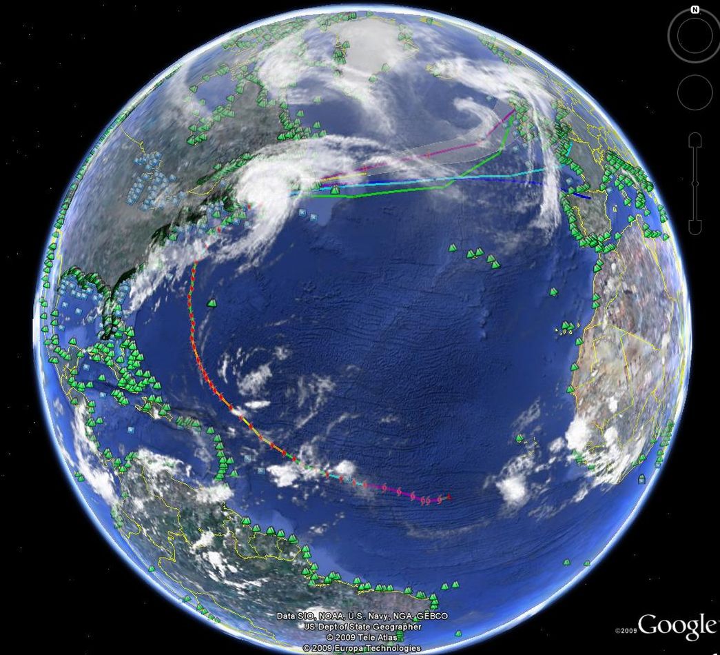
Hallo zusammen
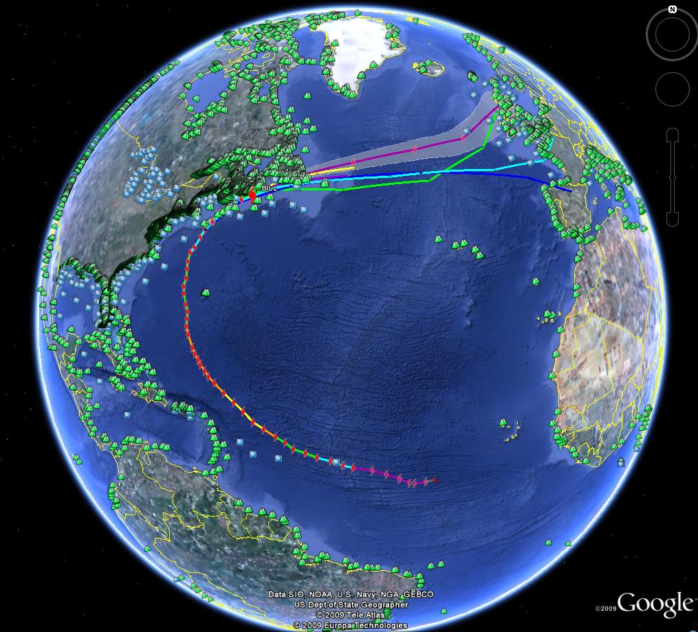
Google Earth ( 24.08.2009 um 00:00 h CEST )
World Tide ( blaues x aufrufbar ) ... World Buoy ( grünes dreieck aufrufbar ) Prediction
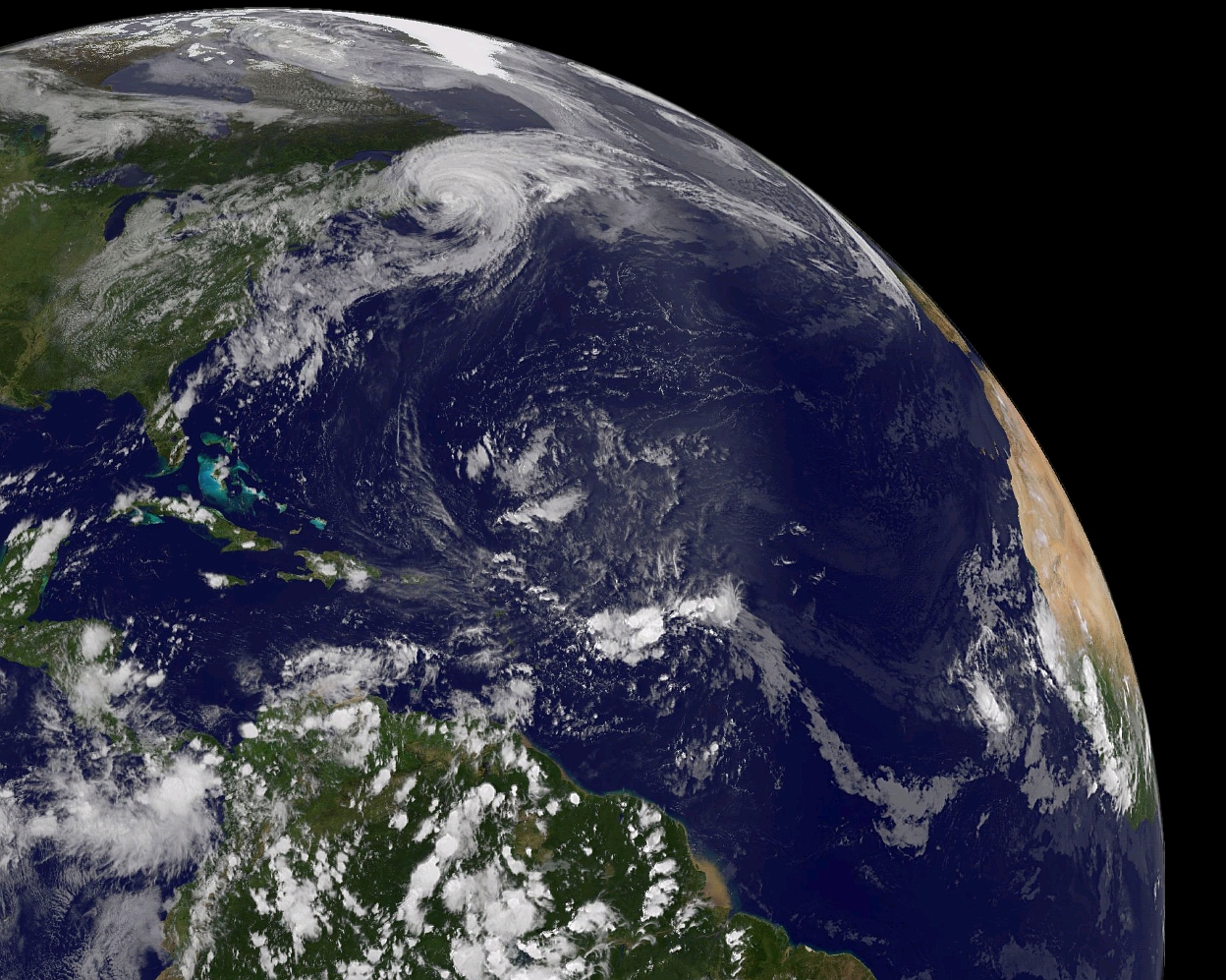
Hurricane Bill ( Cat. 1 ) ...
Global Cloud


=
Bald aber T.S. ( Peak Winds Frcst ) ...


Re: 2009: Tropischer-/Aussertropischer Sturm / Hurrikan / BILL
Verfasst: Mo 24. Aug 2009, 12:49
von URBI
Re: 2009: Tropischer-/Aussertropischer Sturm / Hurrikan / BILL
Verfasst: Mo 24. Aug 2009, 14:33
von Alfred
Das gibt ja noch ein
Vierkörper-Problem!
Alfred
Re: 2009: Tropischer-/Aussertropischer Sturm / Hurrikan / BILL
Verfasst: Mo 24. Aug 2009, 15:20
von 221057Gino
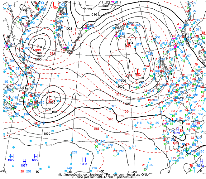
Hallo zusammen
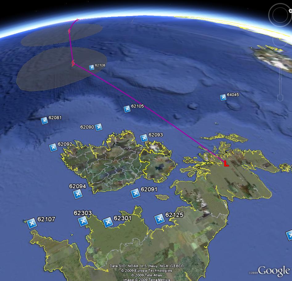
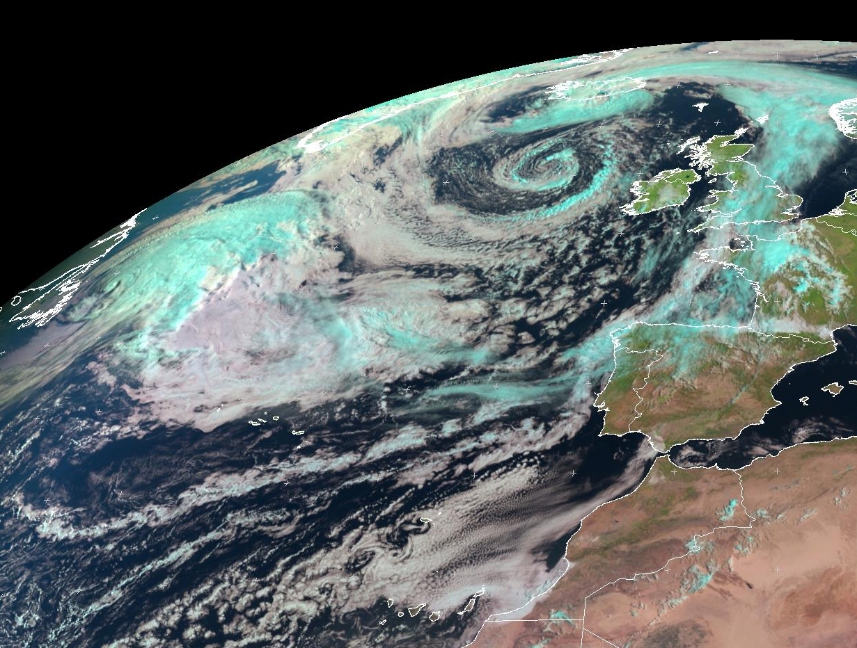
Ex Bill über den Nord Atlantik ...
NEMOC ROTA Spain ...
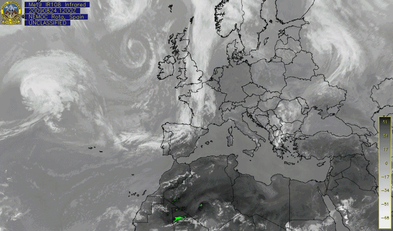
=
@Alfred ( Salü )
Gute beobachtung Alfred ( Respect ).
Aber nicht alles ist Bill. Ex Bill ist der untere links davon ( L 989 mb ).

Quelle:
http://en.vedur.is
http://en.vedur.is/weather/forecasts/at ... #type=temp
=
Falls jemand interessiert ist für Buoys in Europa ( ausser das Mittelmeer ) ... Ich hätte was ...
Re: 2009: Tropischer-/Aussertropischer Sturm / Hurrikan / BILL
Verfasst: Mo 24. Aug 2009, 16:43
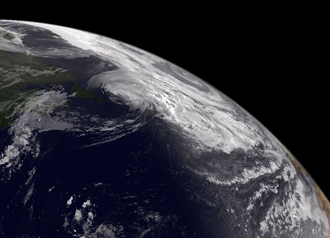
von Alfred
Nur — damit man den
outflow nicht mit dem Tief verwechselt/gleichsetzt!

Gruss, Alfred
Und Nebenbei;
BILL ist Geschichte!


