Seite 8 von 14

Re: Hurricane Saison 2009

Verfasst: Di 11. Aug 2009, 22:23
von Alfred
Hoi zäme

Zwei möchte den Pfad der Tugend (ITCZ) verlassen und fühlt sich zu Höherem berufen!
Bild
http://www.nhc.noaa.gov/tafb/surface_latest.pdf

Gruss, Alfred

Re: Hurricane Saison 2009

Verfasst: Di 11. Aug 2009, 23:05
von 221057Gino
Guten Abend

@Alfred ( Für Alfred ) ... Salü

Real Time Weather West Africa ( Tropical Atlantic Basin )

http://www.atmos.albany.edu/student/janiga/front.htm
Da wo Real Time Weather steht anclicken ...
=
Seasonal Migration of the ITCZ in Africa

http://people.cas.sc.edu/carbone/module ... index.html
=
NOAA ( NWS ) ... Ocean Prediction Center

Tropical Depression 2 ( T.D. 2 )

Bild

Re: Hurricane Saison 2009

Verfasst: Mi 12. Aug 2009, 00:33
von HB-EDY
,,,vorderhand noch ein "eher" laues Lüftchen, aber was noch nicht ist kann ja noch werden...mal sehen... :?: ;)

http://www.ibiseye.com/

und

http://www.stormpulse.com/

and wie heisst's doch "we'll see".... :roll:

salve & good night
Edy

AL 02 2009 / AL 90 2009

Verfasst: Mi 12. Aug 2009, 01:30
von URBI
Eine schnelle Geburtenrate, und schon drängelt der Nachwuchs im Geschehnen des Marktplatzes.

22.00 bis 22.45 UTC
Bild
http://oiswww.eumetsat.org/IPPS/html/MS ... /index.htm

PS:
Die Pfeil-Markierung hat keine Bedeutung.


Grüsse

Re: Hurricane Saison 2009

Verfasst: Mi 12. Aug 2009, 04:15
von Alfred
Hoi mitenand

Ich bin eigentlich auch mehr am «drängelden Nachwuchs» interessiert, aber konnte es doch nicht lassen!
TD2 11. Aug. 21Z plus 168 Stunden
Bild
Gruss, Alfred

AL 02 2009 / AL 90 2009

Verfasst: Mi 12. Aug 2009, 11:01
von URBI
Wie sieht es denn Heute so aus?

TWO 08.30 UTC:
Bild


ANIMATION: Bild

MPE 0230UTC bis 0815 UTC

Bilder: Eumetsat

08.30 bis 09.30 UTC
Bild

Bild
Bis 10.15 UTC

http://rammb.cira.colostate.edu/

Grüsse
Urbi

Re: Hurricane Saison 2009

Verfasst: Mi 12. Aug 2009, 15:10
von 221057Gino
Guten Tag

USA ... Tampa Bay ( Florida ) ...

Ein Link mit guten Loops ( Animationen ) ...
ECMWF ... WRF ... GFS ... NOGAPS ... uvm ...

http://www.myfoxhurricane.com

Re: Hurricane Saison 2009

Verfasst: Mi 12. Aug 2009, 15:59
von Alfred
 
So — das wäre der nächste Kandidat!

Bild
Gruss, Alfred

Re: Hurricane Saison 2009

Verfasst: Mi 12. Aug 2009, 23:00
von 221057Gino
Guten Abend

Tropical Depression 2 ( T.D.2 ) hat es in sich ...
Gibt nicht auf. Könnte sogar noch zu einem Cat.1 werden ...
=
FSU MM5 Tropical Cyclone Prediction

Bild
=
So wie es aussieht scheint der Atlantic nach einem langem schlaf
wieder aufgewacht zu sein ... möchte die verlorene Zeit nachholen ...
=
NOAA ( NHC ... National Hurricane Center )

Bild

Bild

Bild

Re: Hurricane Saison 2009

Verfasst: Do 13. Aug 2009, 03:45
von 221057Gino
Tropical Atlantic Basin

Tropical Development Next Five Days ...
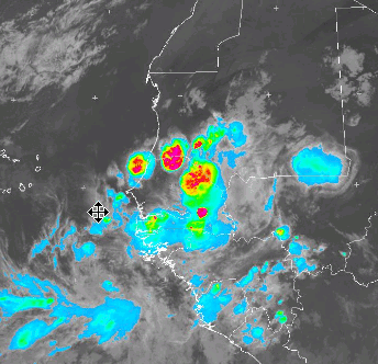
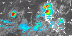
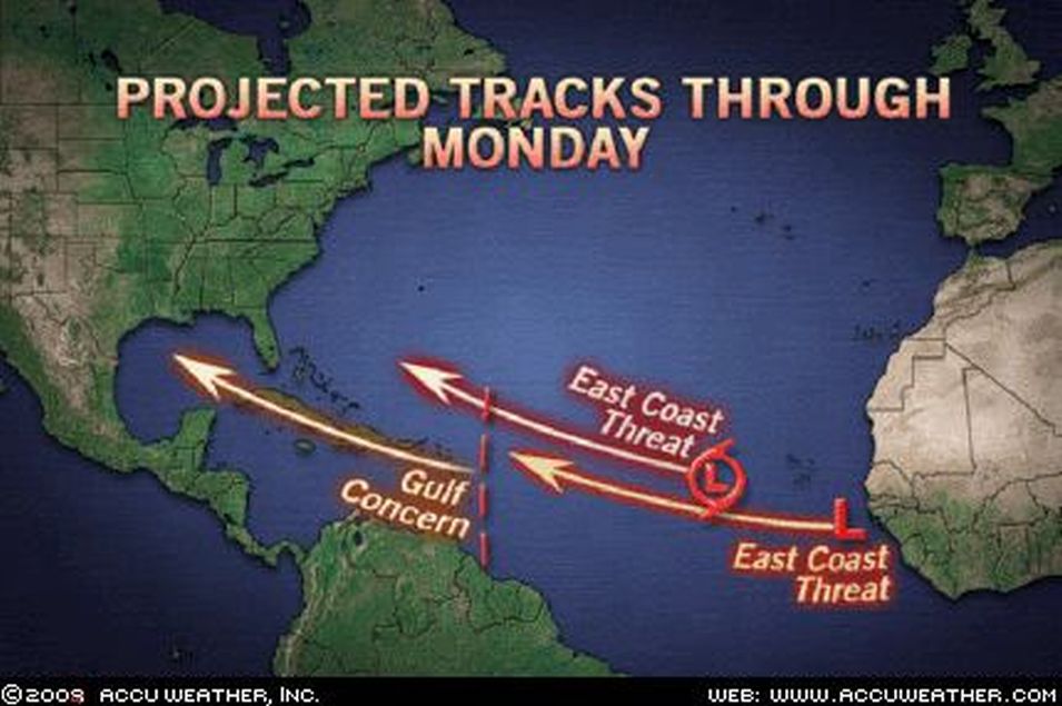
Not One But Three Tropical Systems in the Atlantic ...

Bild

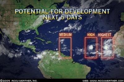
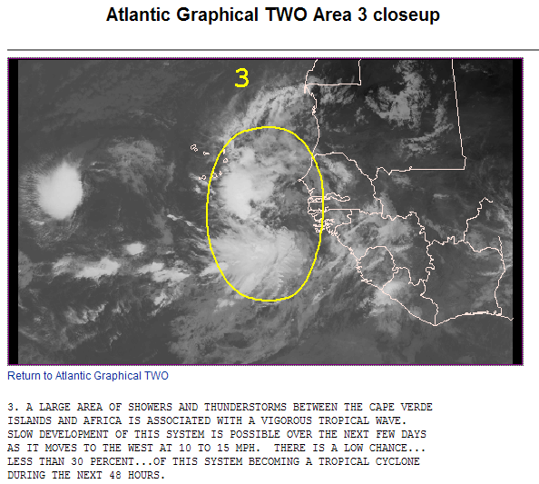
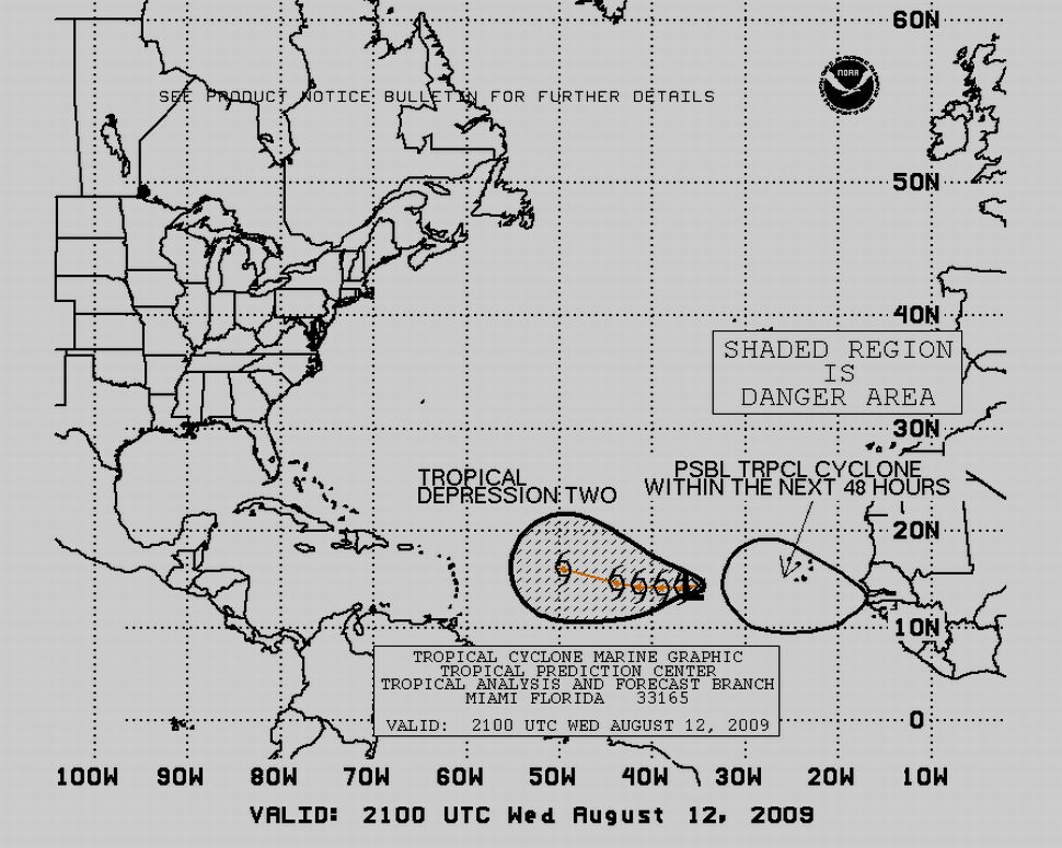
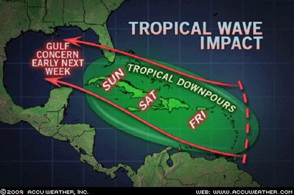
Three trouble spots exist across the Atlantic Basin at the present time ...
=
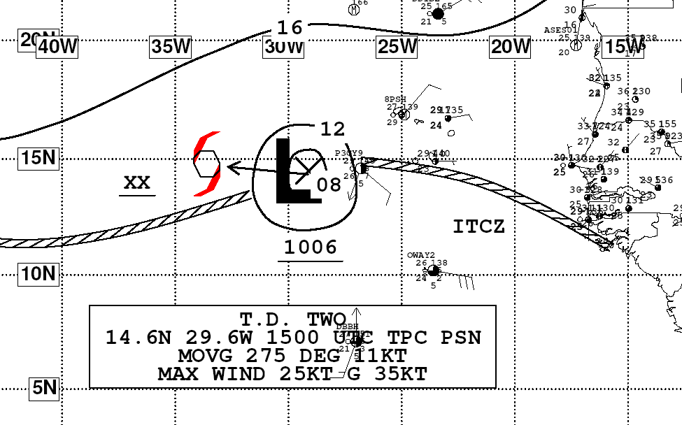
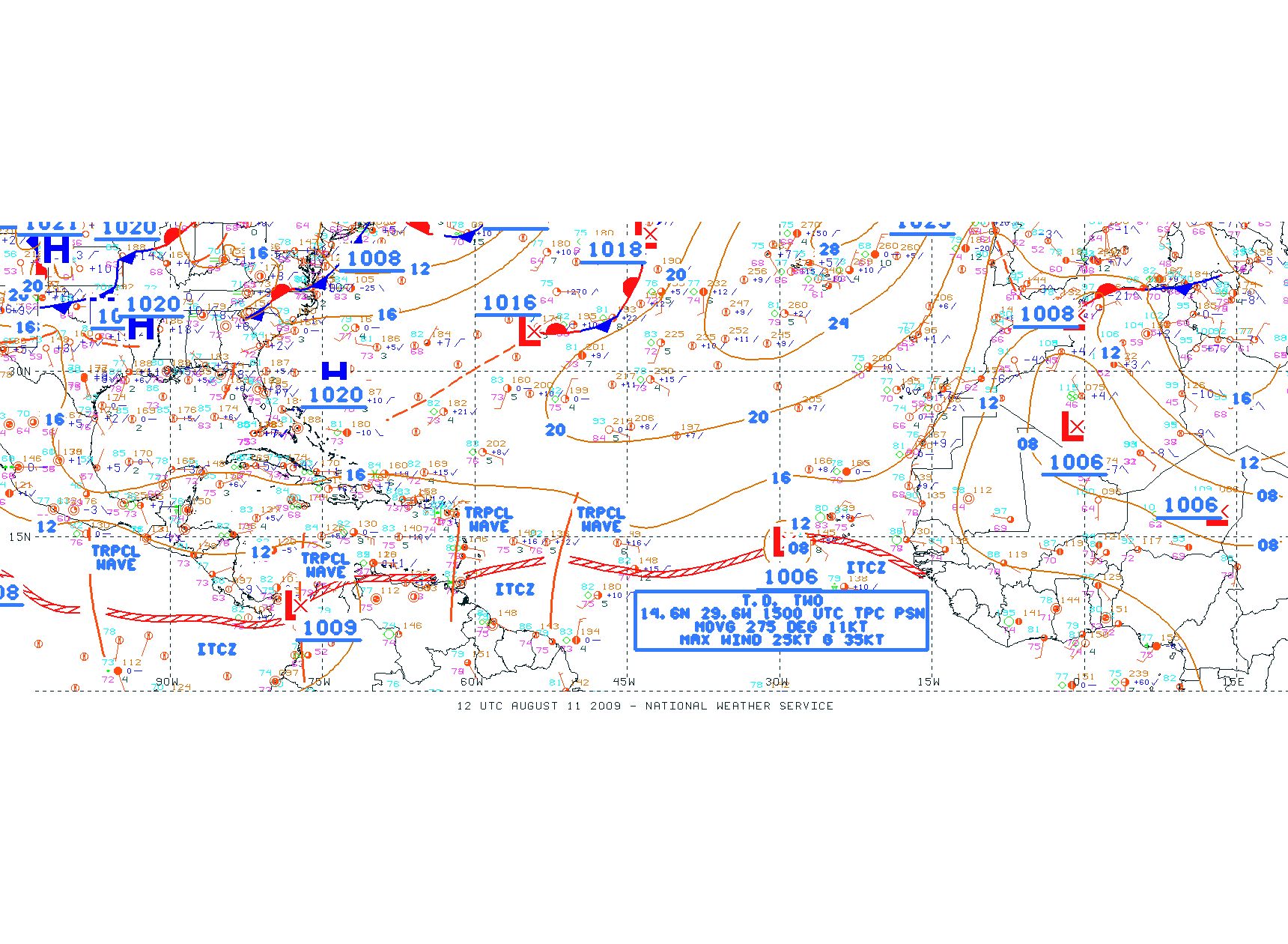
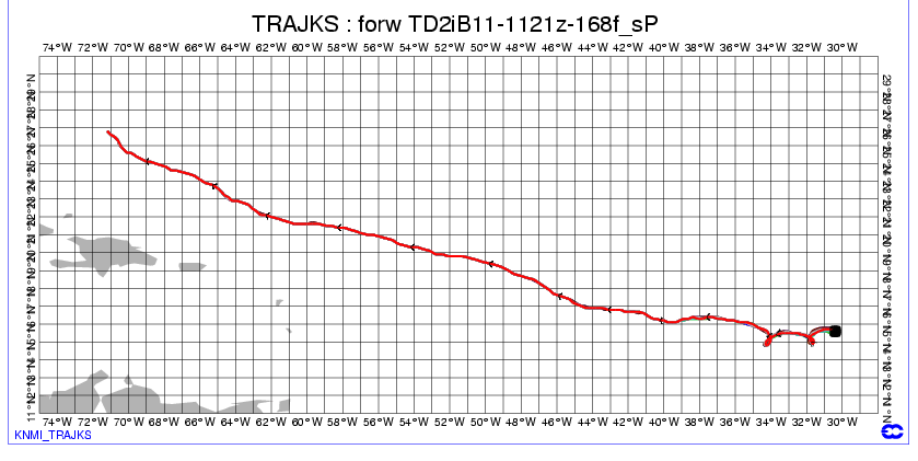
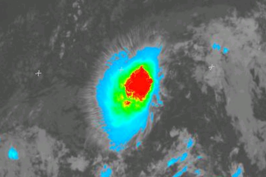
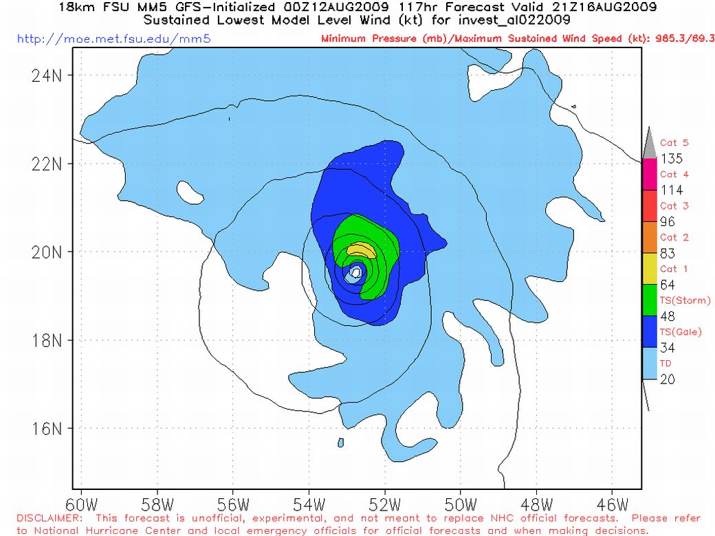
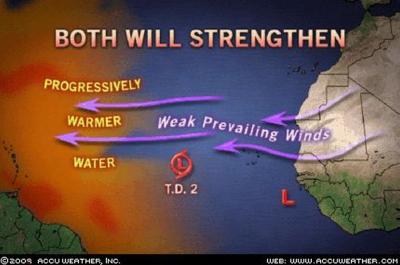
Tropical Depression 2 ( T.D. 2 ) bekommt bald den Namen Ana

The second tropical depression in the 2009 Atlantic Hurricane Season
formed Tuesday morning and it could be named Ana within the next 24 hours ...
=
For den Montag 17.08.2009

Bild

Bild
=
Eastern Atlantic Lights Up

Bild

Bild

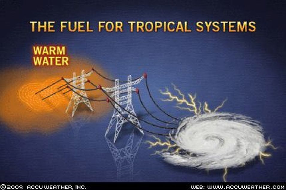
The fuel for monster hurricanes comes from heat stored in the ocean.
This heat is liberated into a developing storm through evaporation and condensation.
In general the warmer the sea surface the more effective this process
is and the stronger the storm becomes.
The inner warmth of a hurricane is critical to storm intensity in that it creates
a large pressure gradient which in turn produces high winds.

At the present time the warmth stored in the ocean has yet to be
tapped by any tropical system.
That means the storms located in the Eastern Atlantic now
have a huge expanse of warm water to cross before they reach any land.
The general consensus among AccuWeather meteorologists is that both
these disturbances will become hurricanes in the days ahead.
Furthermore at least one of these storms is likely to threaten the East Coast
of the United States toward the end of next week.

AccuWeather Expert Senior Meteorologist John Kocet
=
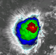
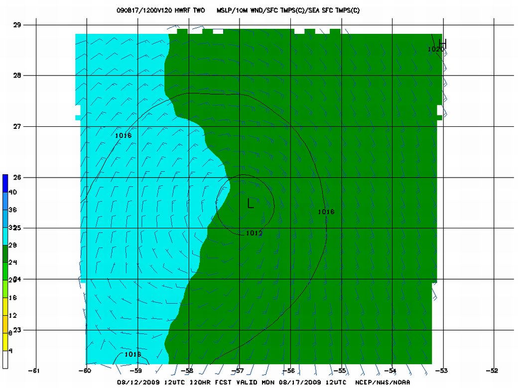
Tropical Depression Two is struggling.
The depression still has a good chance of becoming the Atlantic
hurricane season first named storm Ana this week
but the dry Saharan air that surrounds the storm
combined with moderately high levels of wind shear
are interfering with the storm's organization