Estofex lässt die Schweiz geschickt im Regen stehen..

[EDIT: Sorry Marco, hab dein Post erst jetzt gesehen..]

Trotzdem, es zeigt gut das heutige Schwergewitterpotential in Mitteleuropa. Da Superzellen bekanntlich dazu neigen, auszuscheren (i.d.R. nach rechts), hätte man in meinen Augen auch gut noch die Westschweiz ins Level 1 Gebiet miteinbeziehen können, bzw. die zwei L1 Gebiete miteinander verbinden können.
Aber der Estofex Text lässt einem schon etwas das Wasser im Maul zusammenlaufen..
...SW / S Germany...
Ahead of a developing surface low, easterly / northeasterly SFC winds around 5 m/s are observed in a region between the Black Forest and Hunsrueck with 10 - 15 m/s southeasterly winds in the upper boundary layer. This will result in some spots of strongly enhanced SRH3 (300 - 500 m²/s²) in the vicinity of a SSWerly upper jet streak (20 - 25 m/s deep layer shear). Right now, most of the region is covered by stratocumulus clouds but if the low level clouds dissipate, insolation will lead to 500 - 1000 J/kg CAPE in this region. Any storm that will develop in this environment may become a supercell with a threat of large hail and tornadoes. Later in the period, storms near the cold front will tend to merge into a large MCS with an enhanced threat of heavy precipitation and severe wind gusts. If isolated storms manage to maintain for a long time, an upgrade may be issued.
Towards the southeast, SRH values are somewhat reduced but the chance of insolation is greater. Moderate values of CAPE (~ 1 kJ/kg) and 20 m/s deep layer shear should be sufficient for well-organised multicells and supercells with a threat of large hail. An isolated tornado cannot be ruled out.
Quelle: Estofex.org
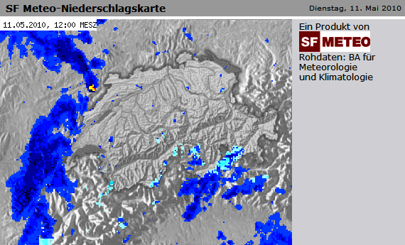
Die Windscherung heute ist ähnlich "gut" wie gestern:
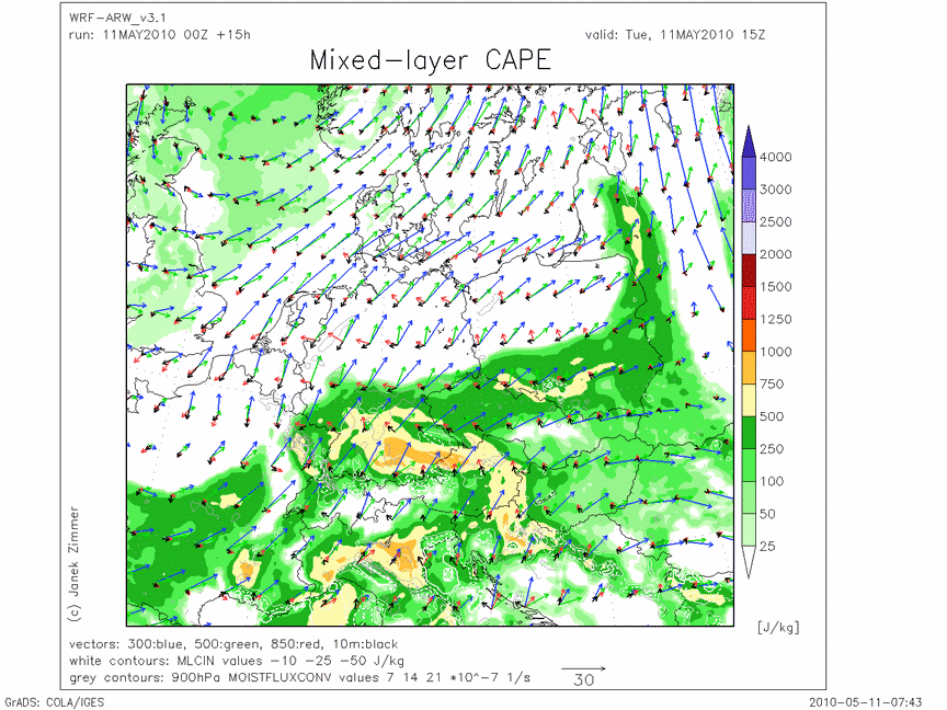
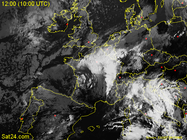
Da über der Schweiz in den nächsten 1-2 Stunden gute Sonneneinstrahlung wahrscheinlich scheint (CAPE building), bin ich bezüglich Gewitter im Schweizer Mittelland eigentlich recht zuversichtlich. Interessanter scheint die Sache allerdings für Bayern zu werden (wieder einmal).
Die Prognose von KERAUNOS geht einen ähnlichen Weg wie Estofex:
http://www.keraunos.org/prevision-orage ... utlook.htm (verfällt)
Gruss Chrigi


