SUMMARY...Environmental signals are continuing to point towards a
tornado outbreak with multiple strong to potentially violent
tornadoes across portions of western and central OK later this
afternoon into the evening.
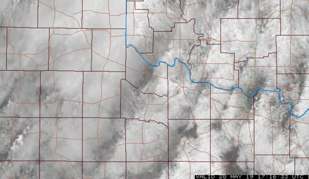
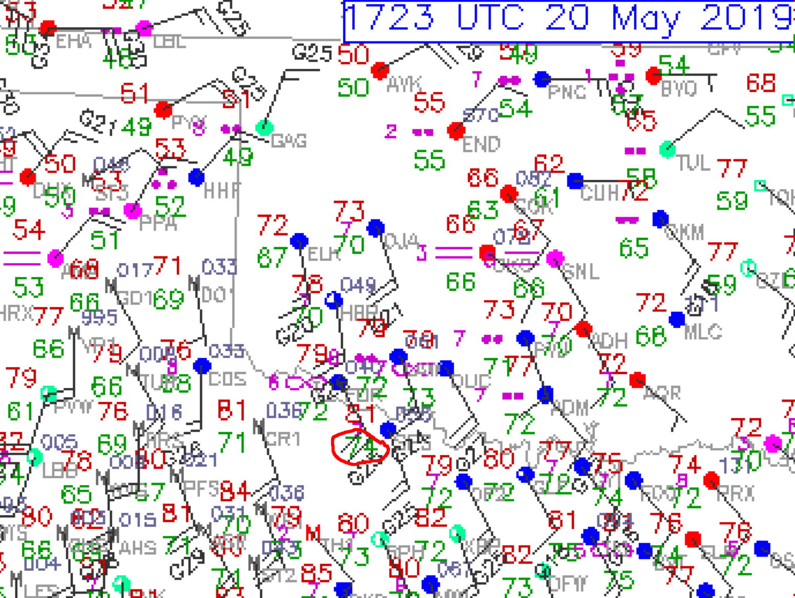
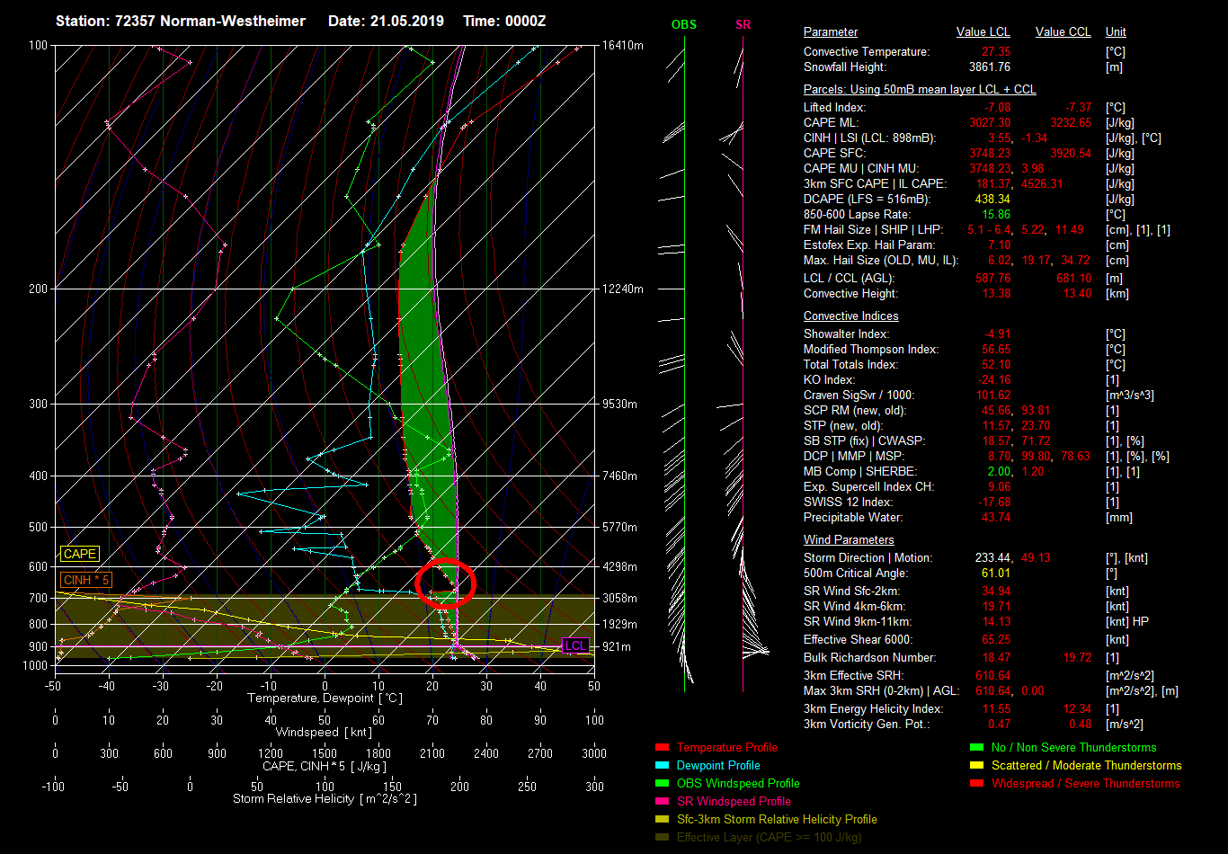
DISCUSSION...Visible imagery shows a bubbling and destabilizing
boundary layer with upwards of 4000-4500 J/kg MLCAPE developing
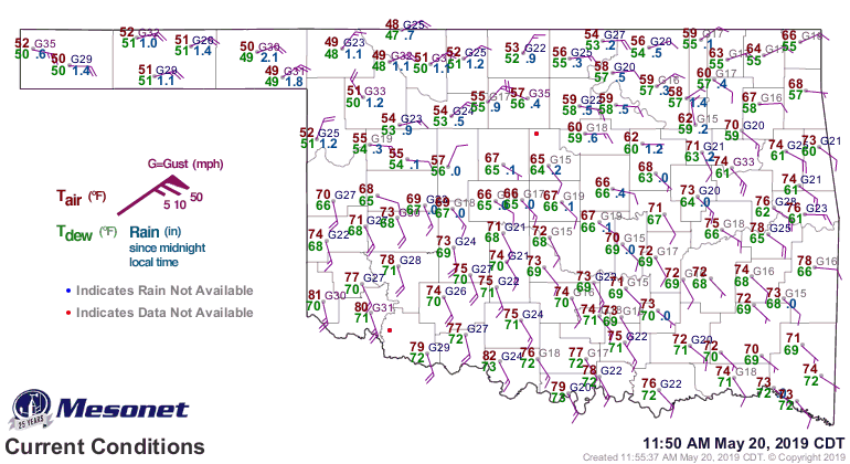
across the warm sector over western and central OK. Surface
dewpoints are rising through the lower 70s degrees F across western
and central OK.
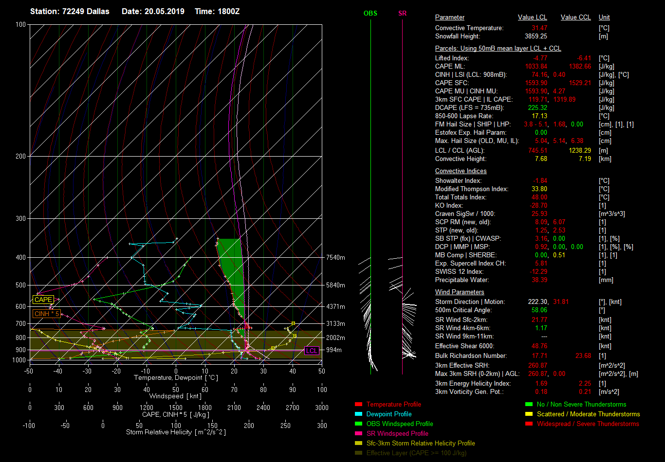
The 18z Fort Worth, TX upper air balloon showed a capping inversion
located just below 700mb. Recent runs of the RAP model show this
inversion less pronounced farther north. Despite temperatures
warming into the lower 80s over north TX into southwest OK, this
capping inversion has delayed convective initiation. This is
concerning for 2 reasons: 1) the wind profile continues to
strengthen across southwest and central OK with the Norman, OK upper
air balloon sampling 50kt flow around 850mb which is about 1-2 hours
earlier than forecast soundings were showing. 2) It does not appear
many storms will develop across southwest OK and resulting in
destructive storm-to-storm interference. In other words, tornadic
potential appears very high. Storms will likely initiate on the
north-end of the cloud streets over southwestern OK in the hotter
air and intensify and move northeast towards the I-40 and I-35
corridors later.
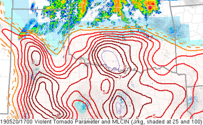
As such, the very rare combination of shear/buoyancy with many hours
of run-to-run consistency of the HRRR model showing discrete
supercells all point to a tornado outbreak developing later this
afternoon featuring strong to violent long-track tornadoes.
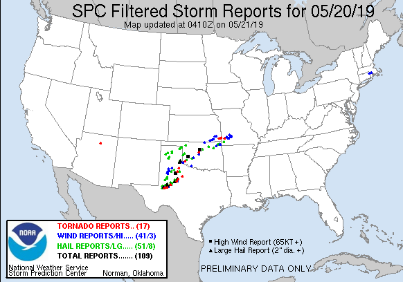
* Primary threats include...
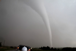
Numerous tornadoes and several intense tornadoes expected
Widespread damaging winds and scattered significant gusts to 80
mph expected
Widespread large hail and scattered very large hail events to 4
inches in diameter expected
SUMMARY...An outbreak of tornadoes, including the risk of intense
and long-track tornadoes, is expected to develop this afternoon
across the watch area. Very large hail and damaging wind gusts are
expected with the numerous supercell storms.
Zuletzt geändert von Bernhard Oker am Mo 20. Mai 2019, 20:45, insgesamt 4-mal geändert.
Founder, Owner and Operator of SSWD - Engaged in Science & Research since 1997.
Follow @SturmarchivCH on Twitter to get accurate information about severe, extreme or unusual weather events in Switzerland - fast and reliable.
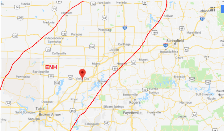
Start Chasing in Pawhuska OK (nördlich von Tulsa OK) mit guter Verbindung in östliche Richtungen. Gesperrte Strassen durch die Überschwemmungen der letzten Tage sind zu beachten. https://twitter.com/tornadoGregMc/statu ... 2751778817
Zuletzt geändert von Bernhard Oker am Mi 22. Mai 2019, 10:00, insgesamt 6-mal geändert.
Bernhard Oker hat geschrieben: ↑Mi 22. Mai 2019, 06:58
Start Chasing in Pawhuska OK (nördlich von Tulsa OK) mit guter Verbindung in östliche Richtungen. Gesperrte Strassen durch die Überschwemmungen der letzten Tage sind zu beachten. https://twitter.com/tornadoGregMc/statu ... 2751778817
Mein virtuelles Chasing starte ich in Vinita City, OK auf halbem Weg zwischen Tulsa, OK und Joplin, MO. Dank I-44 Anschluss habe ich eine (hoffentlich) schnelle Verbindung nach SW und NE.
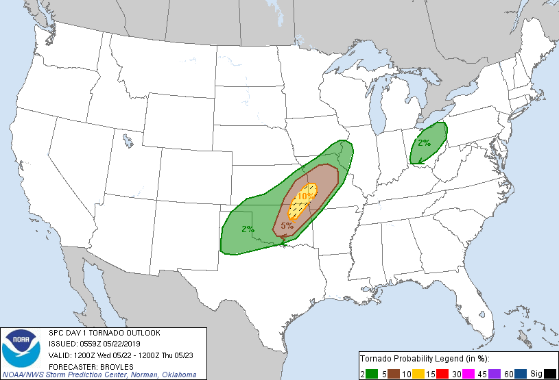
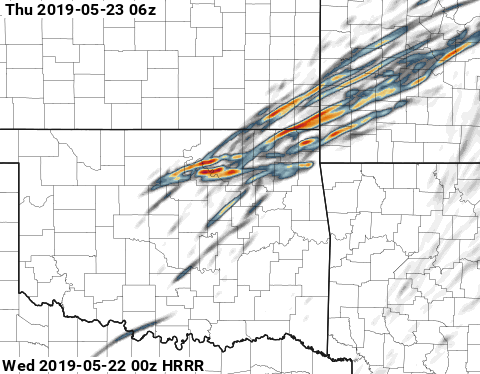
"A significant tornado may occur from near Tulsa northward into far southeast Kansas where the strongest low-level shear is forecast during the early evening."
Quelle: SPC NOAA
Gruss Chris
Zuletzt geändert von Severestorms am Mi 22. Mai 2019, 11:08, insgesamt 1-mal geändert.
Founder, Owner and Operator of SSWD - Engaged in Science & Research since 1997.
Follow @SturmarchivCH on Twitter to get accurate information about severe, extreme or unusual weather events in Switzerland - fast and reliable.