Extended Forecast
Valid: Wed 05 Jun 2019 06:00 to Thu 06 Jun 2019 06:00 UTC
Issued: Tue 04 Jun 2019 02:33
Forecaster: BEYER
A level 2 was issued for parts of Eastern France, parts of Benelux and Western parts of Germany for mainly for large hail, severe wind gusts, and tornados.
A level 1 was issued for the area surrounding the aforementioned LVL1 mainly for the same accompaniments.
.....
SYNOPSIS
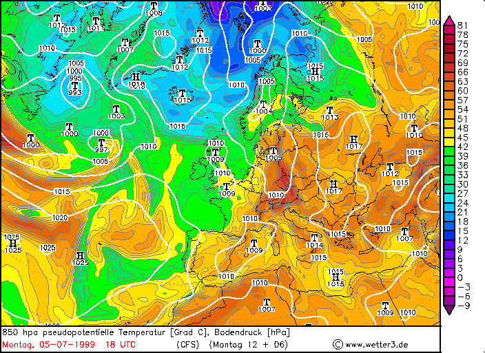
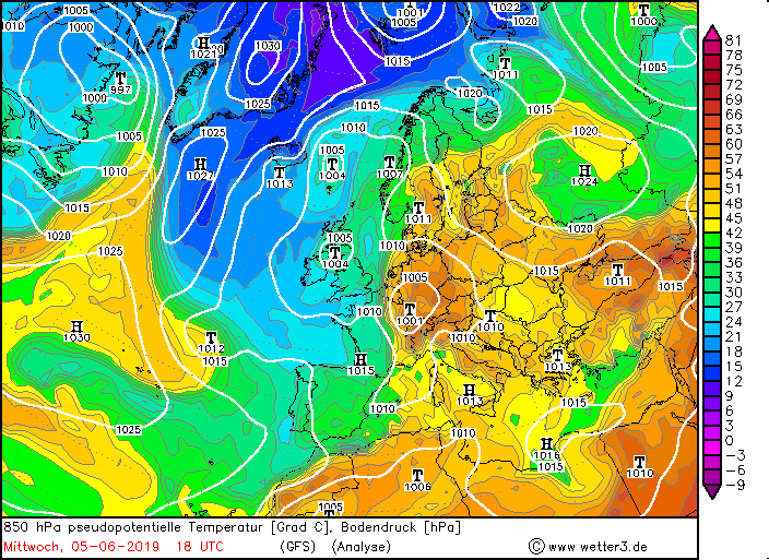
A strongly amplified longwave trough is situated over Western Europa. Its main trough axis is traveling throughout the forecast period from Spain towards France. It initially has a meridional orientation and become zonal orientated while traveling northeastward. It will then get the character of a short wave trough while the main trough itself is rebuilt by downstream developments.
This transition process of the trough and the traveling of the initial main trough axis will be the process of interest for Western to Central Europe. It will lead to the development of a surface low that will under reinforcement travel from France toward the North Sea during the forecast period. This then will lead to an enhanced baroclinity with a strengthening horizontal temperature gradient.
Further downstream a strengthening ridge with a zonal orientated axis will lead to stable conditions.
.....
DISCUSSION
...Parts of Eastern France, parts of Benelux and Western parts of Germany...
An airmass boundary separates cool air over western parts of France from warm to hot airmasses over Eastern France, Benelux, and German. Along the boundary, longer lasting rain is forecasted. Further downstream, in the warm sector, Lapse Rates are forecasted to steepen due to diurnal heating.
Enhanced LL moisture over parts of the area of interest is present and thus will give CAPE values of about 1500 J/kg, locally even more than 2000 J/kg.
However, in parts of the area, one can find drier air masses in the lower troposphere that are mainly due to lee effects on the northern flank of the mountains (strong southerly flow). This insertion of dry air makes the forecast with respect to local effects more complicated.
While during the day, the lack of a clear forcing suppresses convective activity, this will change in the afternoon to evening hours, when the trough axis comes into play. This axis will strengthen the surface low as well as the horizontal temperature gradient. Strong synoptic scale lift is forecasted with the advancing trough axis. This is also supported by the fact that the area of interest is situated under the right entrance region of the upper-level jet.
DLS is forecasted to be around 15 to 25 m/s in the evening hours. During the first half of the night, the strongest shear values are shifting eastward, leaving the area where most of the convection is expected to develop. The same is true for SRH0-3km. However, models partly still show values of 100 to 300 m2/s2 overlapping with developing convection. Looking into prognostic soundings, nicely curved hodographs can be found. LLS is forecasted around 10 to 12 m/s whereas directional shear is more pronounced than speed shear.
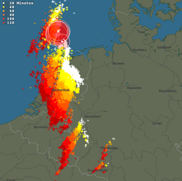
Our current thinking is that convection starts to organize in the late afternoon/early evening hours and will then further organize into a larger mesoscale convective system that is traveling northward during the night.
At the beginning large to very large hail can be expected due to the good CAPE-Shear environment. Later on, the severe wind threat will be the main issue, especially when line segments can form on the forward flank of the system. From 850 hPa upward, a pronounced wind maximum is forecasted that is orientated perpendicular to the axis of organization of the convection. This in combination with the better organization into a mesoscale convective system enhances significantly the risk for severe wind, which may also become widespread.
ACHTUNG: Hier fehlt ein Satz, der sich auf schön gebogene Hodographen und erhöhte SRH Werte bezieht und Tornados als Möglichkeit in Erwägung zieht. Dieser Satz scheint der Forensoftware nicht zu gefallen, selbst wenn ich ihn per Hand abtippe um mögliche Sonderzeichen auszuschließen. Ein Zeichen?! 
The main uncertainty at the moment is how good strong shear values and dynamics can overlap with the developing convection. This strongly depends on the exact time of development of first. The earlier this happens, the better the overlap will be. As a consequence a broad level 1 area was drawn. Embedded is a rather small LVL 2 area that points to the region where we think the overlap of all ingredients is best. The SWODY-1 tomorrow evening will probably give a clearer insight and an adaption of the level areas.