https://www.merkur.de/welt/wetter-in-de ... gn=webpush
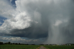
Ich beobachte grad die Morgenkonvektion westlich von mir. Hochbasig und flach oben. Nicht so prickelnd...
Gespannte Grüsse
Ralph
In Zusammenarbeit mit meteoradar

Werbung

Quelle: http://www.estofex.org/cgi-bin/polygon/ ... recast.xmlStorm Forecast
Valid: Wed 05 Jun 2019 06:00 to Thu 06 Jun 2019 06:00 UTC
Issued: Tue 04 Jun 2019 22:02
Forecaster: PUCIK
A level 2 was issued across W Germany, E Holland, E Belgium mainly for excessive rainfall, severe wind gusts and large hail.
...
A level 1 was issued across NW Switzerland, N Italy and Slovenia mainly for excessive rainfall and large hail.
...
DISCUSSION
For details on the synoptic-scale pattern and large scale environment, refer to the extended outlook:
http://www.estofex.org/cgi-bin/polygon/ ... recast.xml
** Forecast text refers only to the changes compared to the extended outlook **
... E France towards BENELUX and W Germany ...
No significant changes were made for this area. That said, uncertainty still exists regarding the surface based convection over W Germany. Models simulate strong precipitation signals in the wake of the cold front, in the zone of the elevated CAPE. With southerly mid-tropospheric flow concentrating cells along an eastward-moving cold front, a training pattern may potentially evolve over western parts of Lvl 2 and Lvl 1. Thus, heavy rainfall was added as a threat in this forecast.
To the north of the advancing surface low, easterly flow veering and increasing with height will contribute to more than 15 m/s of 0-3 km bulk shear and locally over 200 m2/s2 of SRH in the 0-3 km layer. There is a narrow belt, where such strongly sheared conditions overlap with surface based instability. While the initiation in this area is questionable, any storm forming here would be capable of severe wind gusts or large hail.


Generell empfinde ich aktuell draussen keine $chwüle, sogar eher Föhntendenzen selbst hier in der Nordwestschweiz. Die Taupunkte sind hier aktuell mit rund 12° nicht höher als im Osten. Dafür hat nun der Wind aus (Nord)-Ost angezogen. Bin gespannt ob hier die Schwüle/Feuchtigkeit im Verlaufe des Nachmittags noch zunehmen wird. Aus meiner Sicht sind die Konditionen weiter im (Nord)-Westen über Frankreich besser, aber warten wir mal abTinu (Männedorf) hat geschrieben: ↑Mi 5. Jun 2019, 13:21 Interessante Wetterlage. Die wirklich trockene Föhnluft macht sich derzeit eigentlich vor allem im Bündnerland bemerkbar (siehe Taupunkt und Feuchte-Daten auf metradar.ch). Sonst sieht das eigentlich noch alles durchaus fruchtbar aus, bezogen aufs Gewitterpotenzial, resp. ich erkenne keine grösseren Unterschiede zwischen West und Ost...

Werbung