Gruss
Martin
In Zusammenarbeit mit meteoradar

Werbung

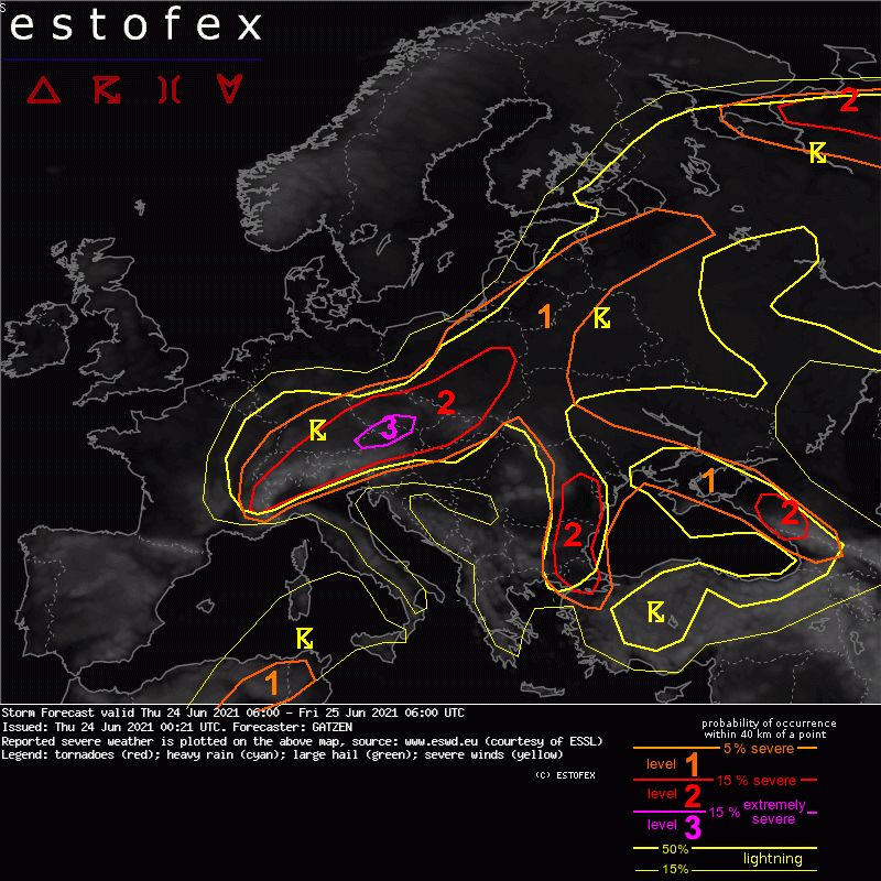
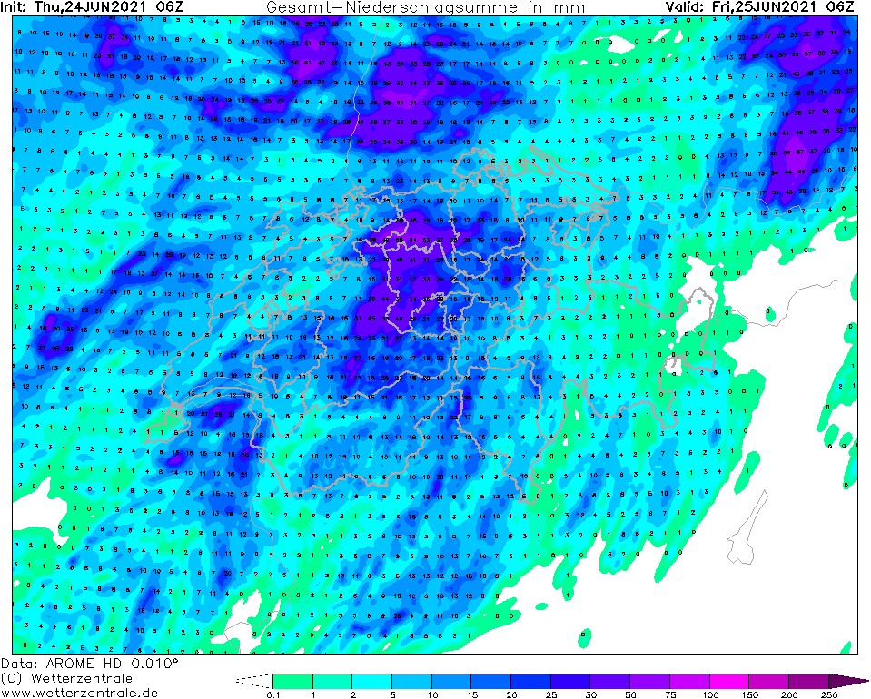
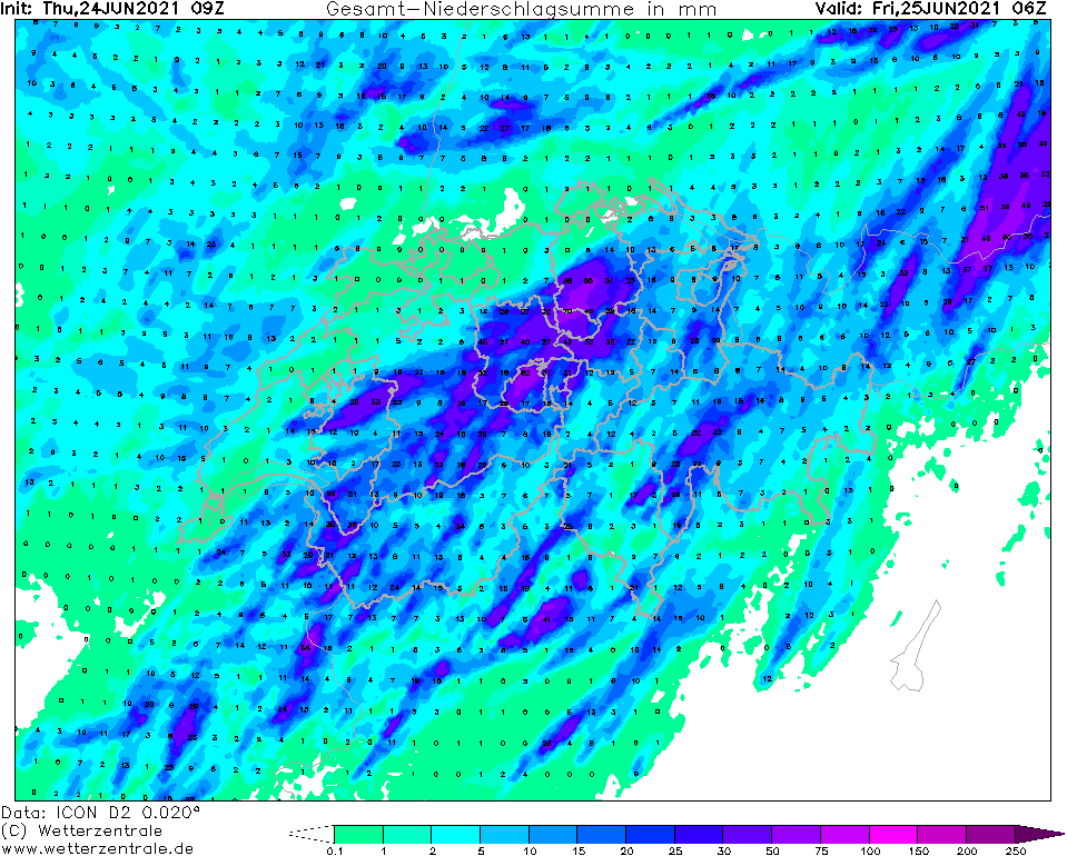
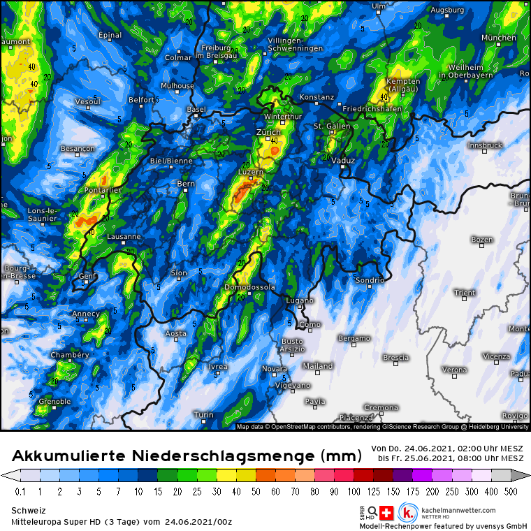
Quelle: estofex.orgWestern and northern Alpine region into SE Germany, Czechia, Slovakia and S Poland
A strong south-westerly mid-level jet slowly progresses eastward on Thursday. An embedded short-wave trough spreads north-east and associated differential vorticity advection increases during the day. At lower levels, a frontal boundary extends from the western Alps towards SE Germany and into Czechia. Moist and unstable air are present to the south-east of this boundary. In response to pressure falls north of the Alps, moisture will return westward during the day and warm air advection sets in.
Convection initiation will become more likely during the day, with a peak of convective activity in the evening. Main focus will be storms forming along a cold front that progresses over southern Germany in the afternoon, but more isolated storms are also possible in the warm air advection regime farther east. Strong deep layer shear of 20 to 30 m/s will support supercells capable of giant hail and severe wind gusts. A level 3 was issued for the area with highest expected storm coverage.
Due to the high coverage of storms and strong 0-3 km wind shear, formation of foreward propagating MCSs and bow echoes is expected, with severe winds becoming the main threat. A tornado is not ruled out, with increasing potential across Slovakia due to strong low-level vertical wind shear that develops in the evening.
Clusters elevated storms are expected to persist for most of the night while progressing across Poland, with slowly decreasing risk of severe wind gusts and large hail.


Werbung