
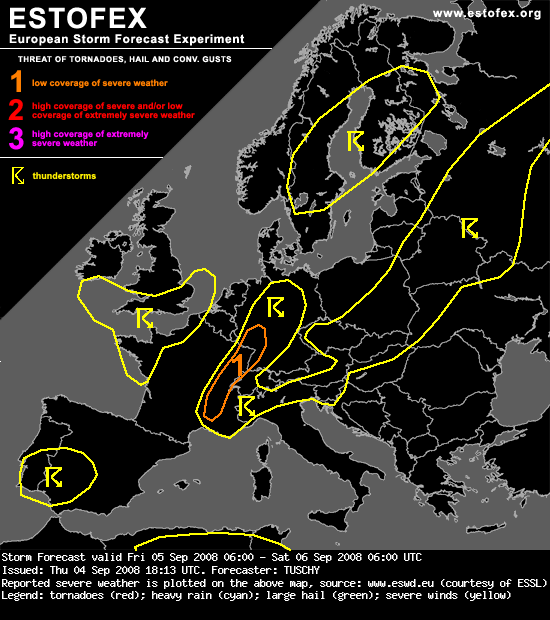
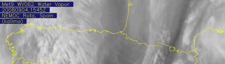
... SE/E-France and SW-Germany ...
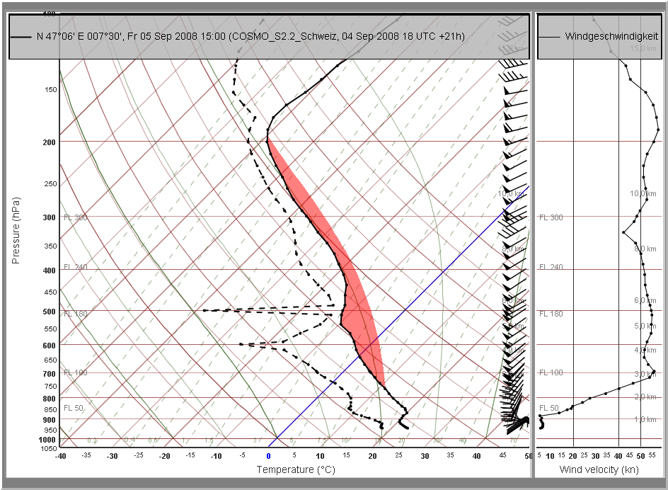
Complex pattern of surface fronts, as warm-front lifts northward over E-France during the morning/midday hours and cold front approaches from the west during the afternoon hours. Behind this front, a very warm/humid BL airmass spreads to the north, covering those areas during the afternoon hours. As mid-level lapse rates exceed 7°C/km and at least marginal diabatic heating pushes surface temperatures to at or above 25°C, pockets of moderate instability release will likely develop with readings of 500 J/kg. For sure, thermodynamics will be the main concern during this set-up, as shear will be very strong (DLS 25m/s, LL 15-20m/s and 150-250 m^2/s^2 SRH-1) and LCLs won't be too high (around 1km during the midday hours but decreasing afterwards).
Despite those favorable parameters, there remains a few uncertainties left. Numerous UVV maxima cross the area during the day, resulting in a potential prolonged period of initiation, so a thick cloud shield and stable BL due to outflow air could keep instability release even less than currently anticipated. Even with limited activity during the day, a slowly eastward moving cold front, serving as another focus for initiation during the afternoon and evening hours, should be more or less a solid line of potential trailing storms due to a front-parallel background flow, so discrete thunderstorm development is questionable. Nevertheless, a level-1 will be introduced and an upgrade for parts of SE/E-France may become necessary, if either instability or storm mode will be more supportive for an enhanced tornado threat. Otherwise, large hail and severe wind gusts will accompany stronger storms.
The wind gust risk could become more widespread over extreme E-France / W-Germany, if storms line-up, as wind field at lower levels remains strong. Rapidly decreasing instability and aforementioned orientation of the cold front preclude higher probabilities for now.
Gruss Chrigi


