Seite 4 von 7
Re: 26.-28.02.2010: Orkantief Xynthia (West-/Mitteleuropa)
Verfasst: Sa 27. Feb 2010, 19:54
von Enzo
Vigilance
ROUGE pour le centre-Ouest de la France
Bonne soirée venteuse.
Gruss
Enzo
Re: 26.-28.02.2010: Orkantief Xynthia (West-/Mitteleuropa)
Verfasst: Sa 27. Feb 2010, 21:03
von URBI
Re: 26.-28.02.2010: Orkantief Xynthia (West-/Mitteleuropa)
Verfasst: Sa 27. Feb 2010, 21:05
von 221057Gino
Hallo zusammen
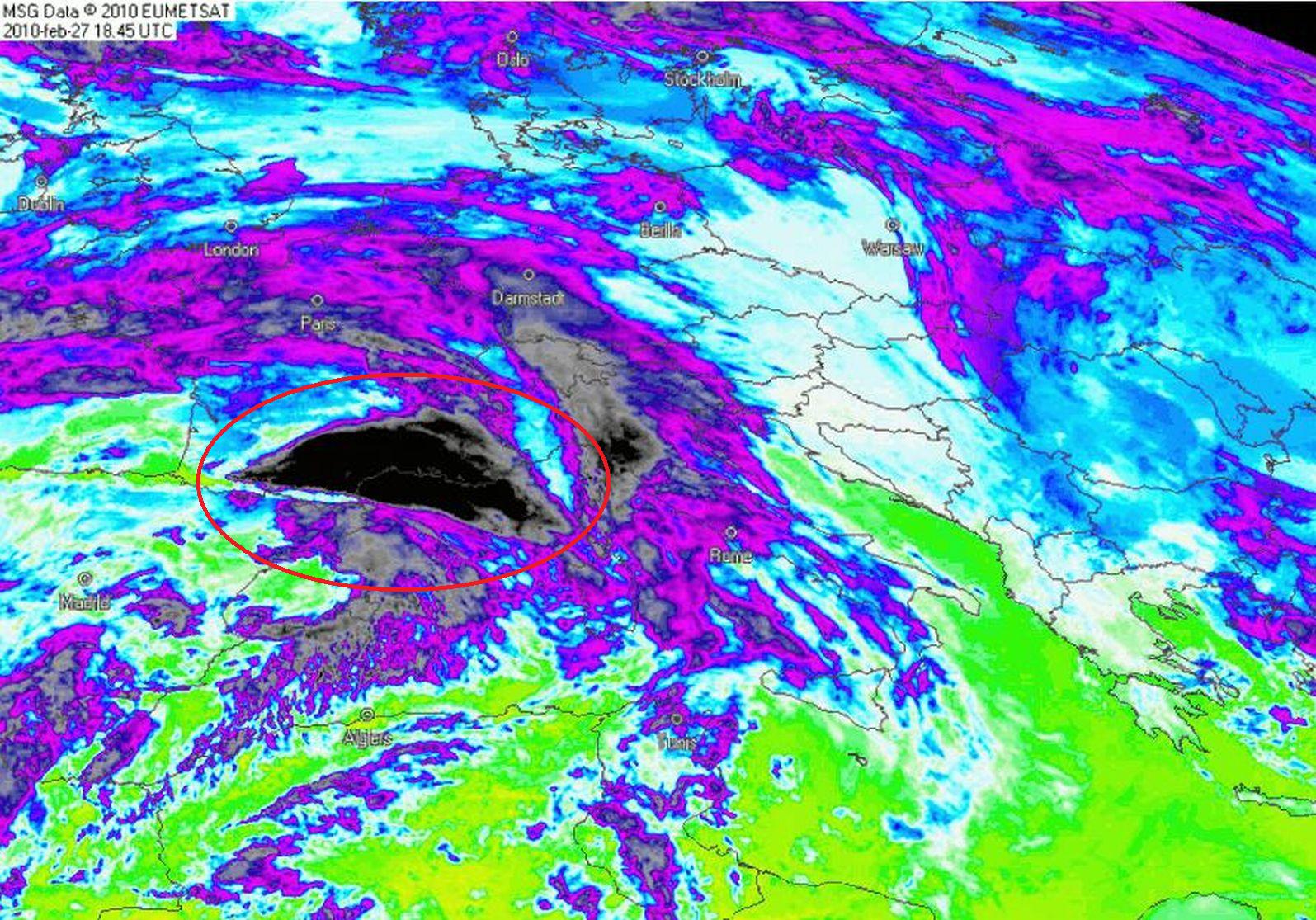
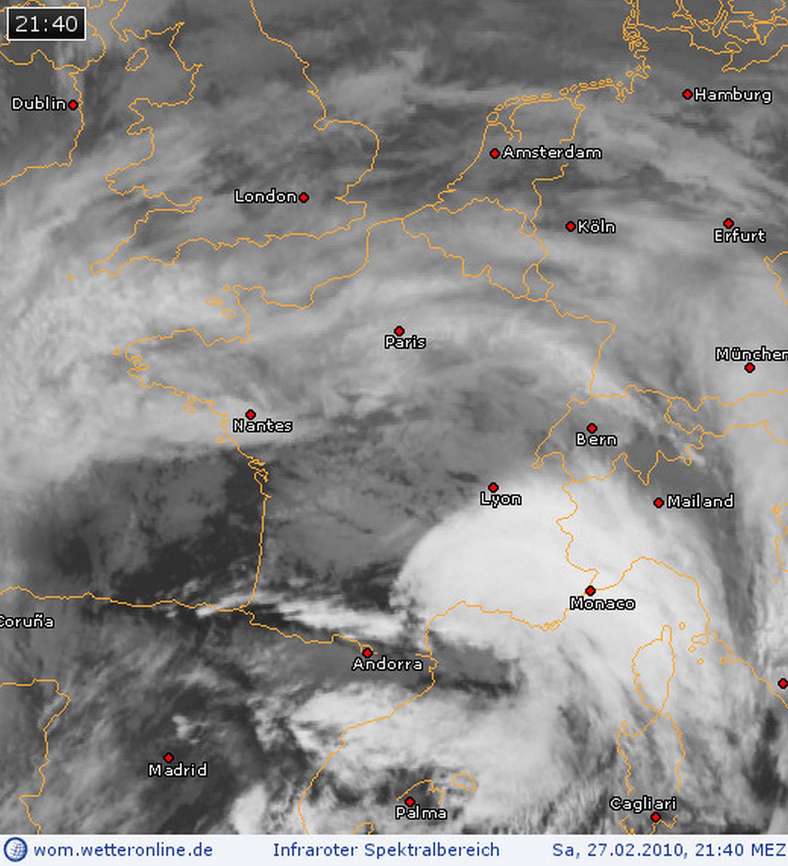
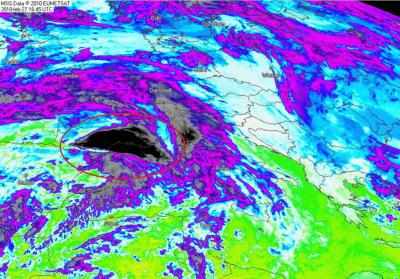
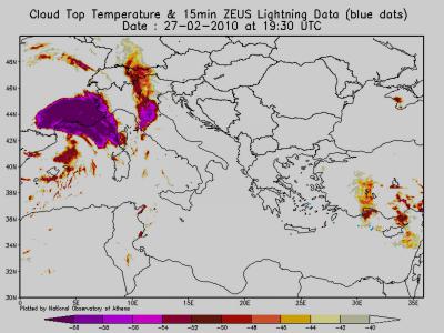
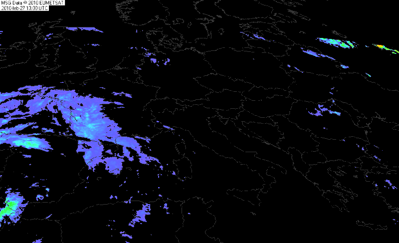
Pyrenäen ( Satbild ) ...
Was formiert sich denn da ? ...
Satbild ( Loop 4.25 MB )

=
Satbild ( Loop 2.25 MB )

=
Precipitation ( Loop )
Re: 26.-28.02.2010: Orkantief Xynthia (West-/Mitteleuropa)
Verfasst: Sa 27. Feb 2010, 21:50
von 221057Gino
Re: 26.-28.02.2010: Orkantief Xynthia (West-/Mitteleuropa)
Verfasst: Sa 27. Feb 2010, 22:12
von Andreas -Winterthur-
@ Enzo:
Salut!
Habe mich schon heute Nachmittag gefragt, wieso dass MF die Südhälfte explizit nicht warnt.

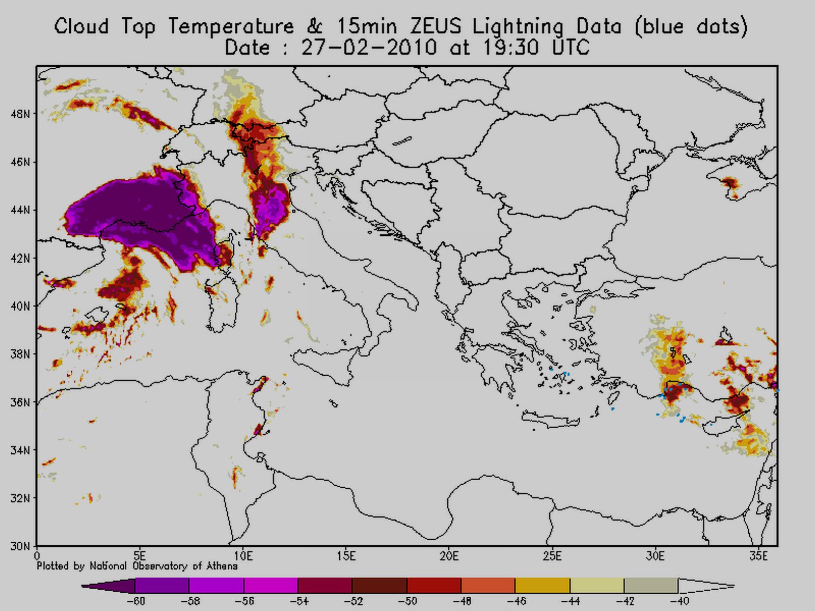
Dort werden aktuell die höchsten Böenspitzen gemessen. Teils >100 km/h bis in tiefe Lagen:
http://www.infoclimat.fr/cartes/france/ ... 1267305179
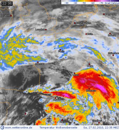
@Gino:
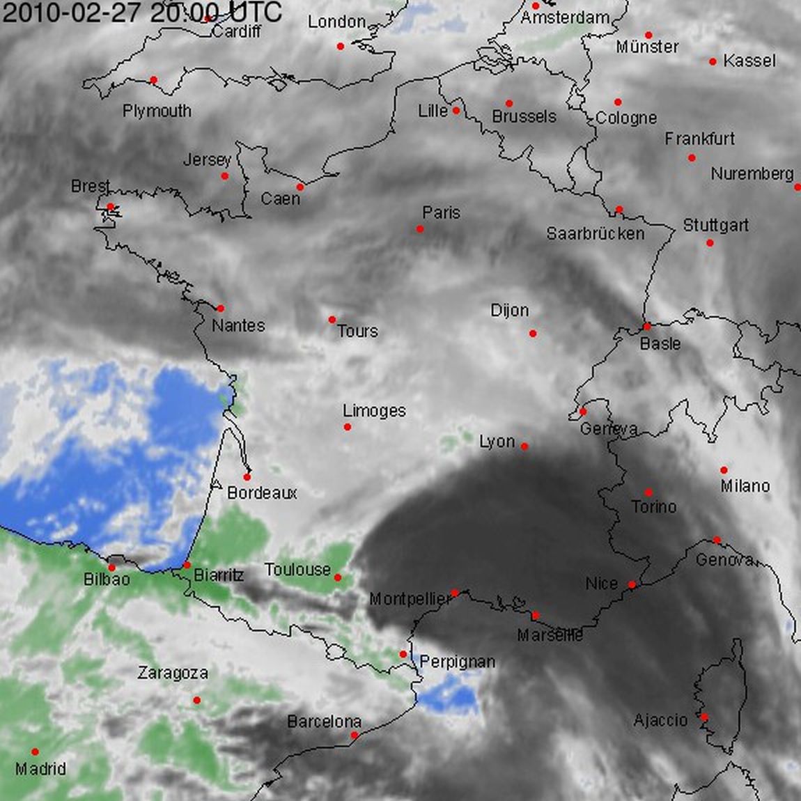
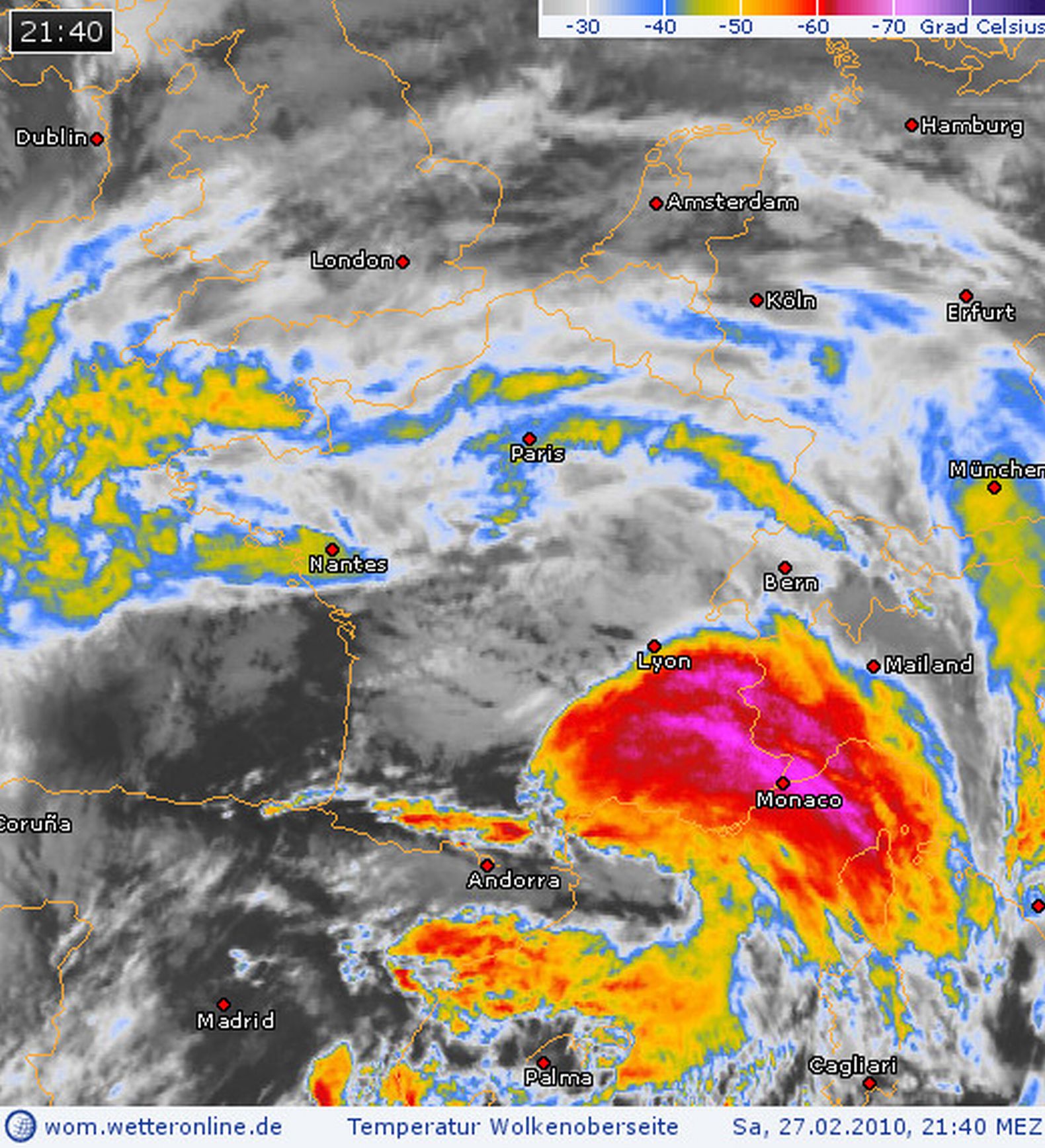
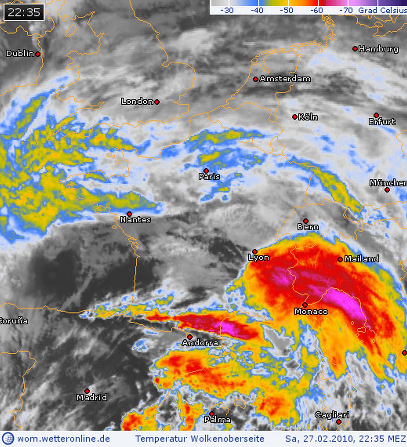
Hochreichende Leewellen Bewölkung bedingt durch die quer zur Strömung stehenden Pyrenäen.
http://expert.weatheronline.co.uk/daten ... 8_2712.gif
Ebenfalls eindrücklicher Föhngradient über die Pyreneäen. Pau am Fusse der Berge Temperaturanstieg von 12 auf 24°C innerhalb einer Std. (19 bis 20 Uhr). Gleichzeitig ist die Luftfeuchte auf 31 % gesunken. Siehe Grafik:
http://www.infoclimat.fr/stations-meteo ... 27&s=07610
Gruss Andreas
Re: 26.-28.02.2010: Orkantief Xynthia (West-/Mitteleuropa)
Verfasst: Sa 27. Feb 2010, 22:29
von Marco (Hemishofen)
Re: 26.-28.02.2010: Orkantief Xynthia (West-/Mitteleuropa)
Verfasst: Sa 27. Feb 2010, 22:31
von Andreas -Winterthur-
@Marco:
Off Topic: Dopplet gnäit, het besser...

cu tomorrow
Re: 26.-28.02.2010: Orkantief Xynthia (West-/Mitteleuropa)
Verfasst: Sa 27. Feb 2010, 22:40
von Andreas -Winterthur-
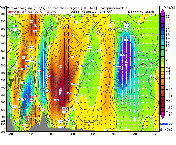
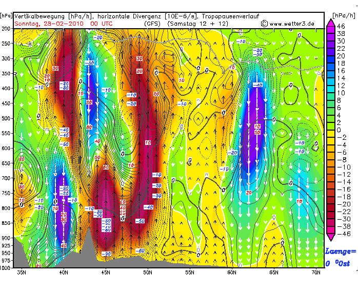
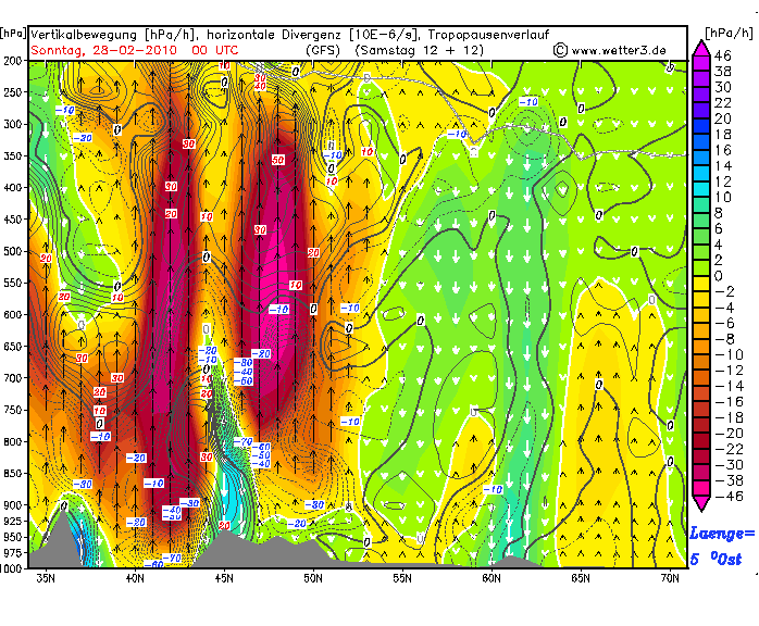
Übrigens auch nicht alltäglich:
Heftiger Föhn gleichzeitig über 3 markante Gebirgszüge in Mittel- und Westeuropa:
Alpen / Pyrenäen sowie kantabrisches Gebirge
Re: 26.-28.02.2010: Orkantief Xynthia (West-/Mitteleuropa)
Verfasst: Sa 27. Feb 2010, 22:41
von 221057Gino
@ Marco aus Stettfurt ( Hallo )
@ Gino: das ist eine Leewelle der Pyrenäen
Vielen Dank Marco
=
Und hat das evtl. ein einfluss ( zusammenhang ) mit dem Orkantief Xynthia ?
Oder hat sich das per Zufall zusammengebraut ?
Sorry mein german ausdruck ...
Re: 26.-28.02.2010: Orkantief Xynthia (West-/Mitteleuropa)
Verfasst: Sa 27. Feb 2010, 22:45
von 221057Gino
Edit ...
@ Andreas ( Winterthur )
Danke auch an dich für die ausführliche Antwort ...
=
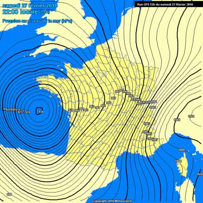
Surface Pressure