

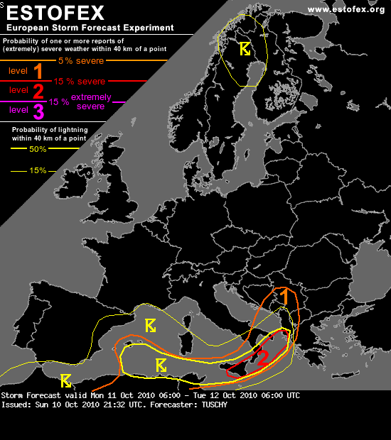
Valid: Mon 11 Oct 2010 06:00 to Tue 12 Oct 2010 06:00 UTC
Issued: Sun 10 Oct 2010 21:32
Forecaster: TUSCHY
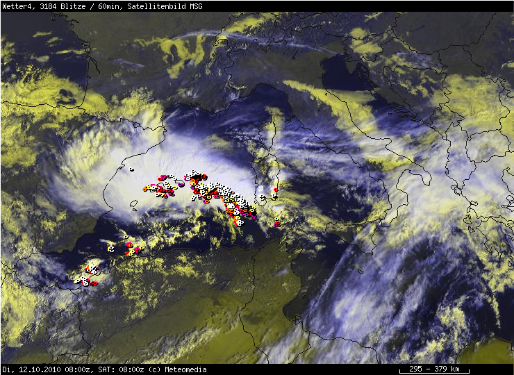
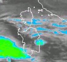
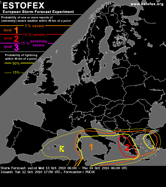
A level 2 was issued for Sicily, S-Italy and the N-Ionian Sea mainly for excessive rainfall, large hail, severe wind gusts and tornadoes.
A level 1 surrounds the level 2 with a more limited risk. The primarily hazard will be heavy rainfall.
A level 1 was issued for the Balearic Islands and SE-wards mainly for excessive rainfall amounts. Strong wind gusts, large hail and an isolated tornado event are also possible with more discrete storm structures.
SYNOPSIS
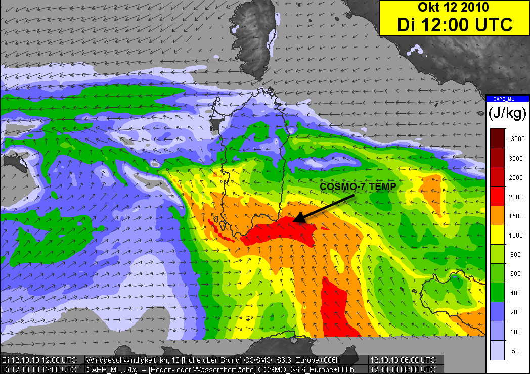
An intense trough over NE Europe builds southeastwards with strong CAA affecting a large area. There are signals for some convection over N-Norway/Sweden, but updraft strength looks too weak for longer-lived thunderstorms which could take profit of intense shear. Another, major upper low over the western Mediterranean remains in place and causes widespread shower/thunderstorm activity. Stable conditions prevail over NW-Europe.
Tropical storm Otto just north of the Azores probably acquires enough post-tropical characteristica for extratropical transition although phase diagrams still indicate a chance for a deeper warm core structure. Nevertheless, no heavy rain risk affects the Azores during the upcoming 24 hours.
DISCUSSION
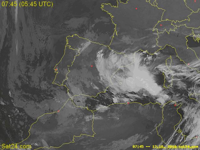
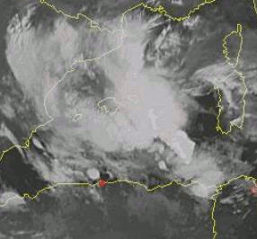
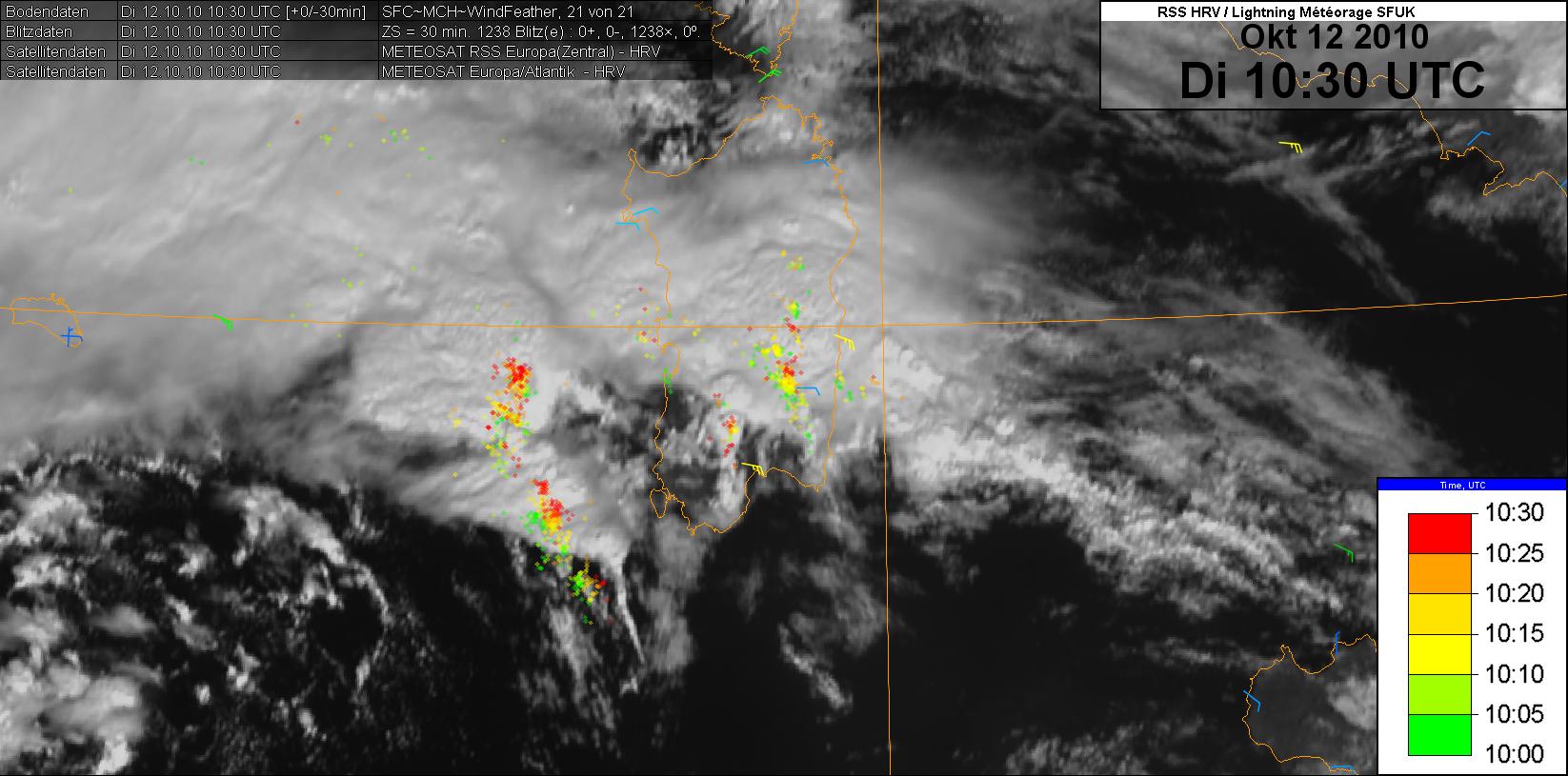
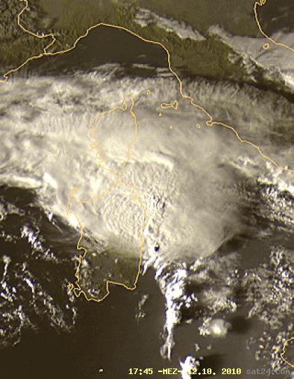
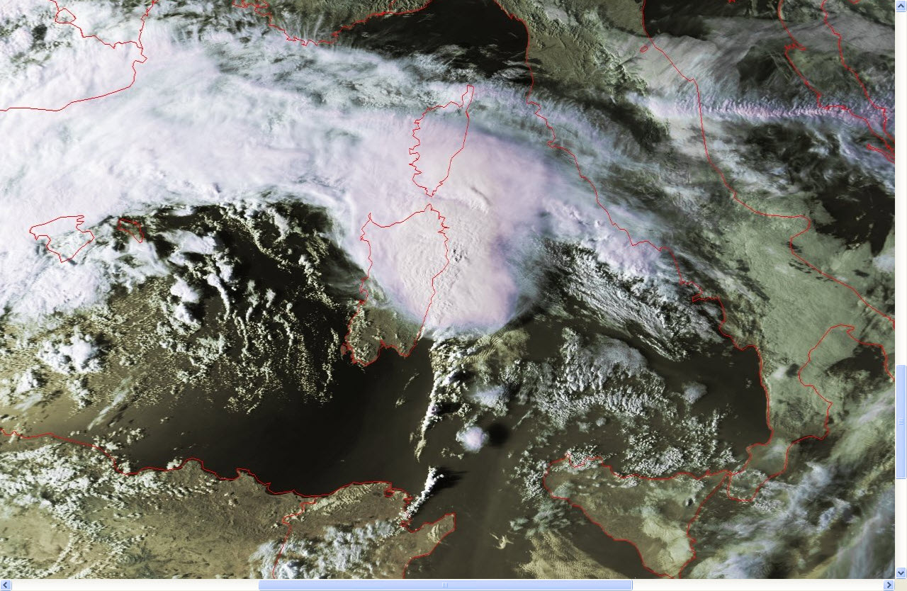
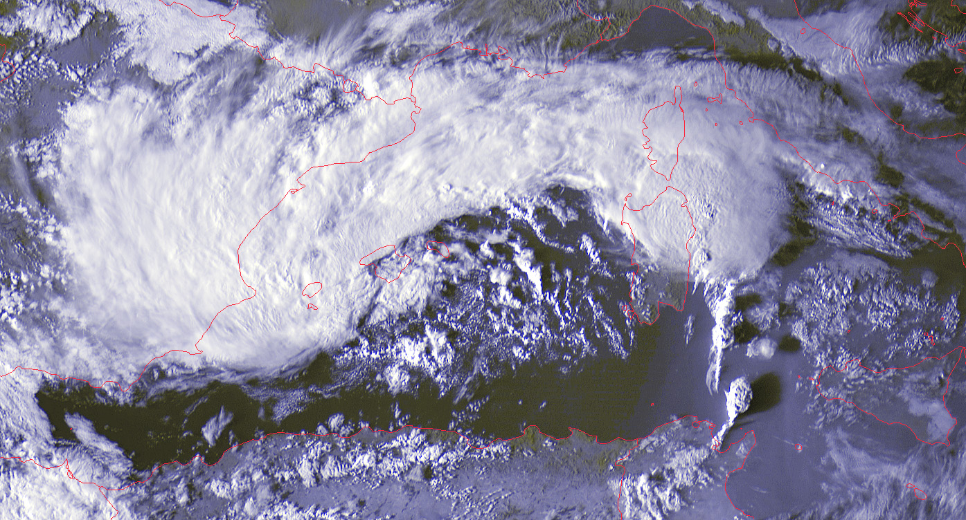
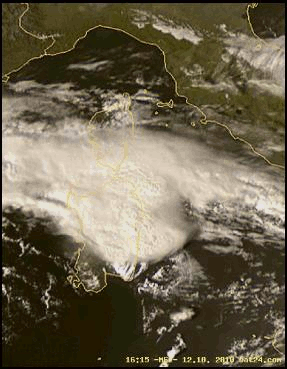
... Tyrrhenian Sea, Sicily, S-Italy, parts of the S-Adriatic Sea and the N-Ionian Sea ...
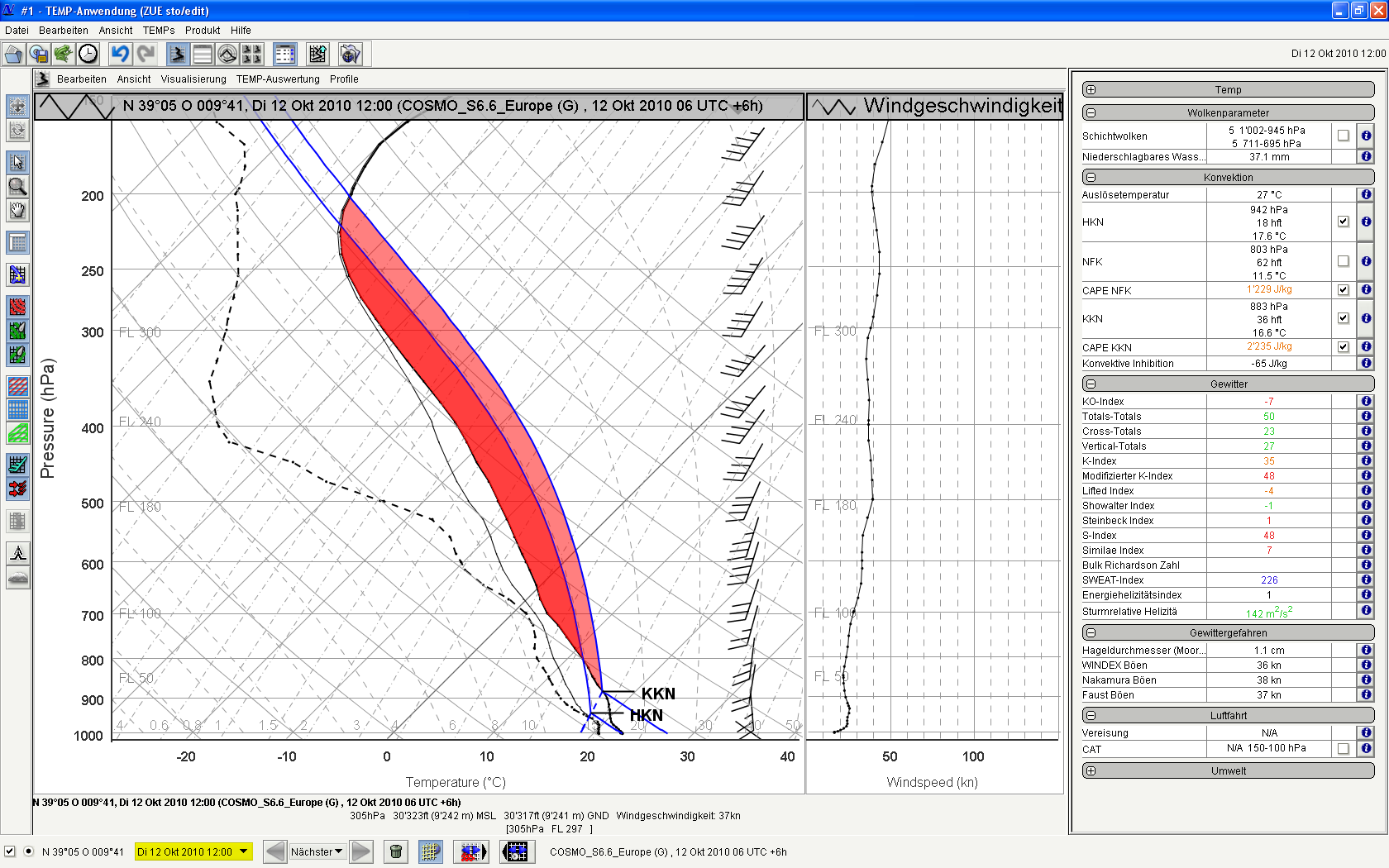
As the upper low over the Iberian Peninsula digs southwards, a potent mid-/upper jet ejects out of its base and builds rapidly eastwards. Adjacent geopotential height falls over the area of interest are weak to non-existent, as mid-/upper ridge slides eastwards. However, pressure decreases beneath 3km with a very moist and warm BL air mass in place, so the environment sets up for a continued risk of excessive rainfall and severe.


