heute könnten wir mitten drin statt nur dabei sein, zumindest wenn man rein vom Estofex Outlook ausgeht...:
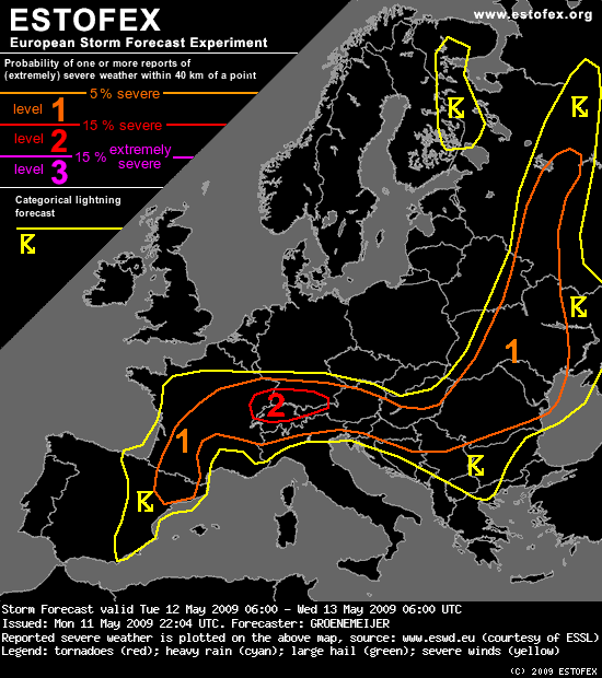
http://estofex.org/cgi-bin/polygon/show ... recast.xmlStorm Forecast
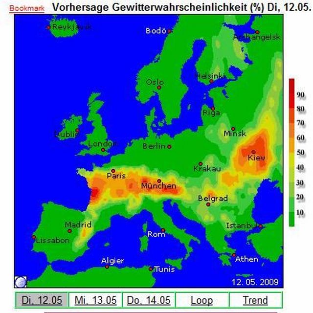
Valid: Tue 12 May 2009 06:00 to Wed 13 May 2009 06:00 UTC
Issued: Mon 11 May 2009 22:04
Forecaster: GROENEMEIJER
....
A level 2 was issued for E France, S Germany, N Switzerland, and NW Austria mainly for large hail, and severe winds.
....
SYNOPSIS
Tuesday at 0600 UTC, mid-level charts feature an intense trough from northern Scandinavia to W Poland. During the forecast period, a low cuts off from the trough and becomes established over Smolensk Oblast. There, intense surface cyclogenesis is also expected as the upper-level systems interacts with a frontal zone. Upstream of the trough, a ridge stretches from the Shetlands to W Germany. Further upstream, a low is situated over the Bay of Biscay. On the SE flank of that low, a 30 m/s jet streak is present from SW Iberia to the Alps. While being well-defined in the lower troposphere also, it tends to propagate downstream somewhat during the period. A subtle shortwave ridge over Iberia moves NE ward and connects with the Shetland-W Germany ridge. A baroclinic zone stretches across eastern Spain towards central France. A clear surface front stretches eastward across Europe, from the Paris region eastward across southern Germany to N Hungary, to E Belarus -- where the surface cyclogenesis is expected -- and onwards along the Valdai Hills to the northern Russian Plain.
DISCUSSION
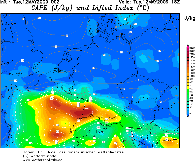
E France, S Germany, Switzerland, Austria, N Italy...
A rather moist air-mass that has become stagnant south of the warm front mentioned above. As this air-mass is warmed during the day, CAPEs well in excess of 1000 J/kg, possibly up to 2000 J/kg are expected to form north of the Alps. This, in combination with strong 20-25 m/s shear, will lead to a situation in which rotating storms can develop with ease. Scattered storms will probably form in the early afternoon in response to diurnal heating. They will bear a threat of large hail. A risk of severe winds will also exist. The risk of tornadoes appears not to be exceptionally large, because of the relatively low 0-1 km shear. However, high amounts of low-level buoyancy and locally enhanced shear may still allow for one or two tornadoes to develop, especially in vicinity of the front.
The storms may continue into the evening, but will gradually subside.
Across the Alps and on the southern flanks of the Alps, storms are also expected to occur. Instability will be less, so the threat of large hail will be a bit lower, but still significant. Some severe wind gusts are possible in addition to the hail threat.
....
Gute Nacht,
Benni