
Hallo
@Alfred ( Hoi )
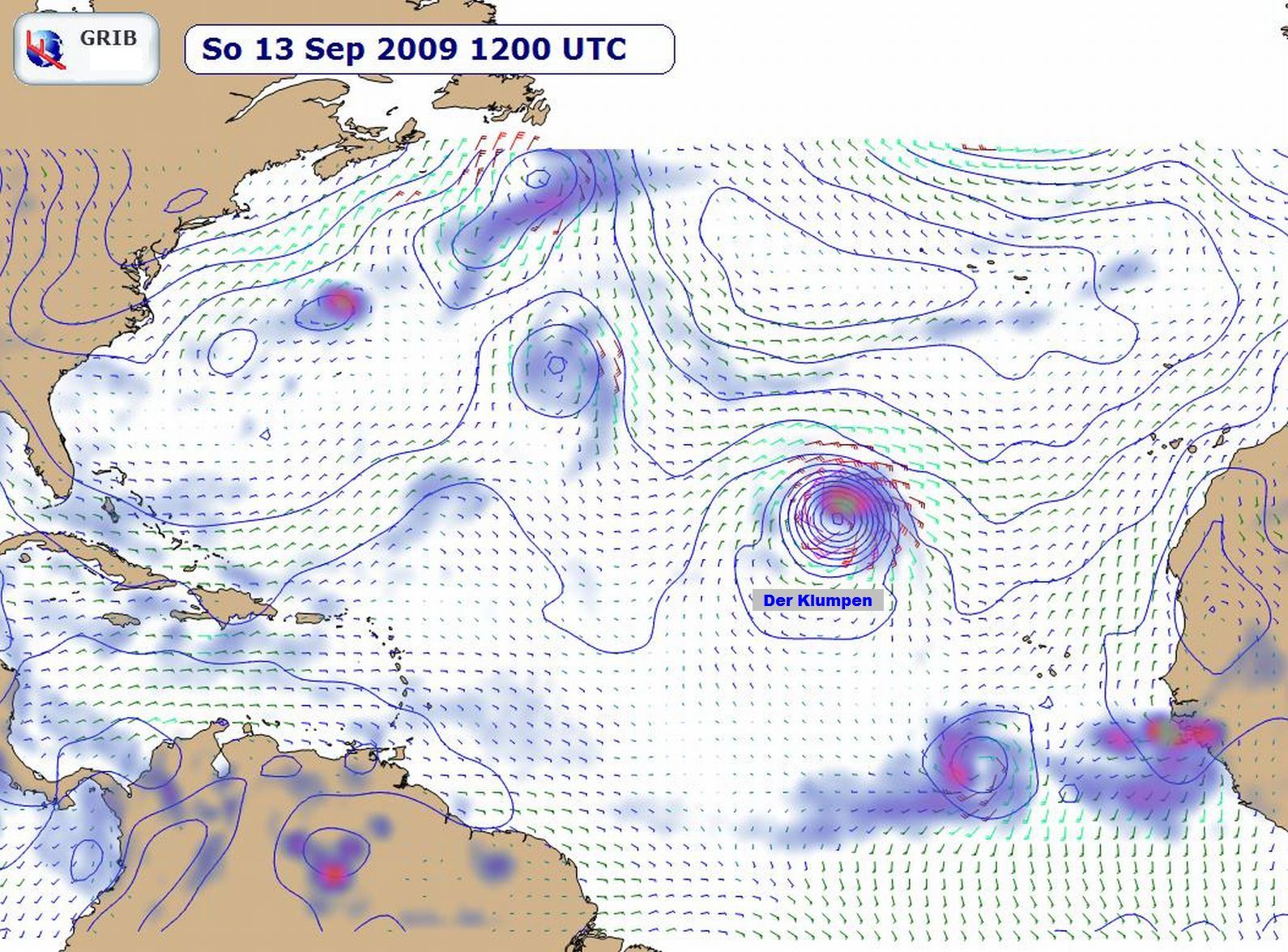
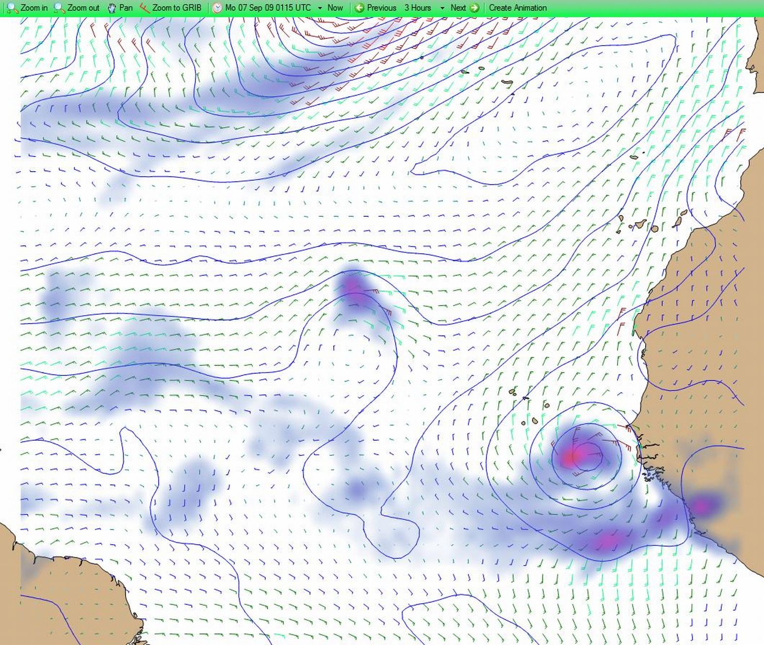
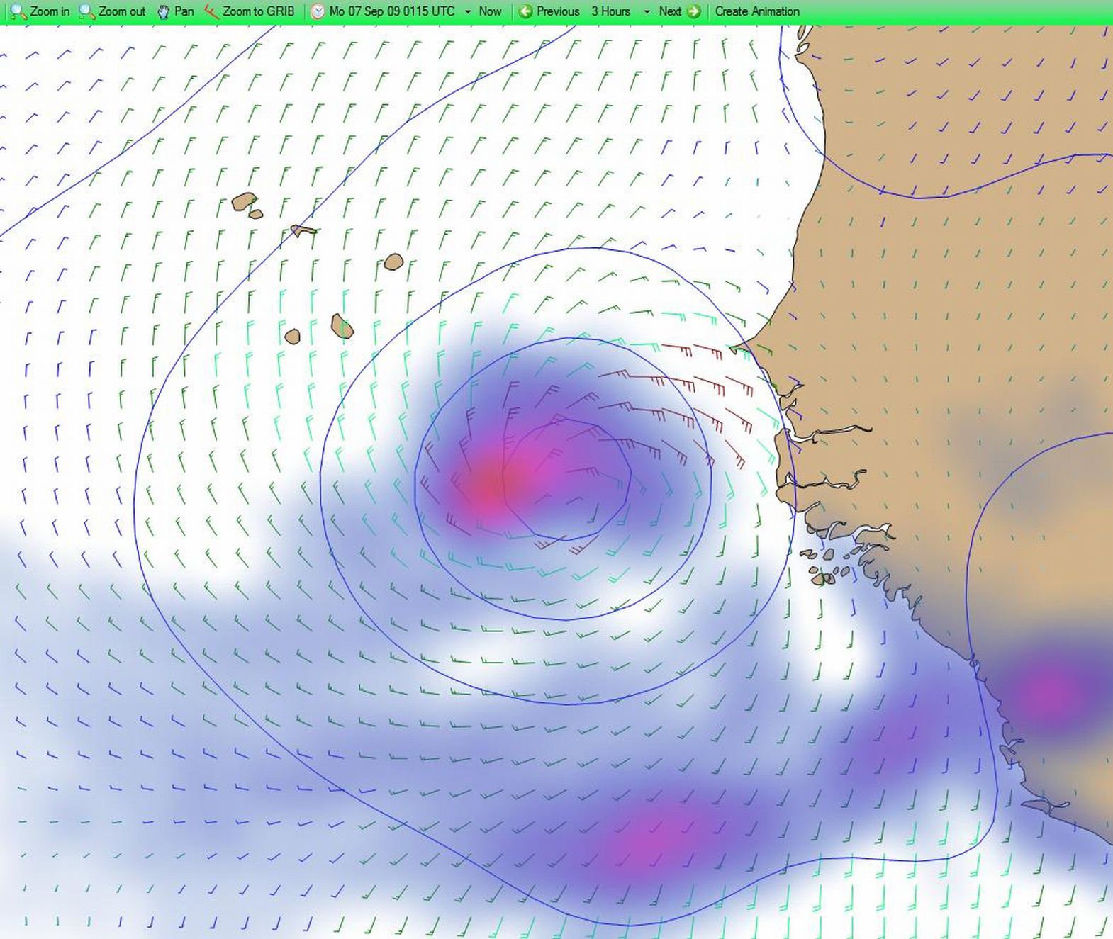
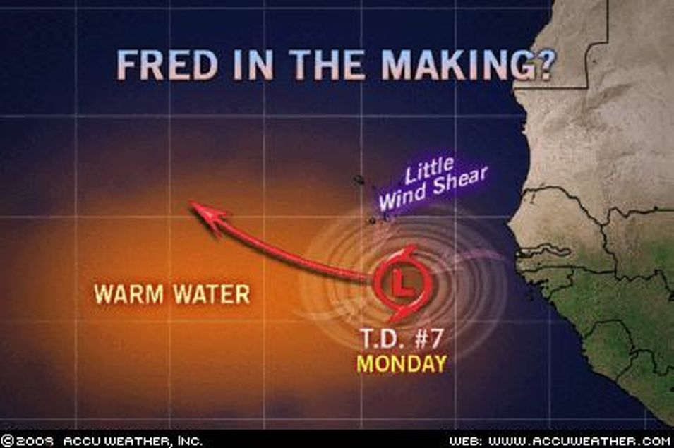
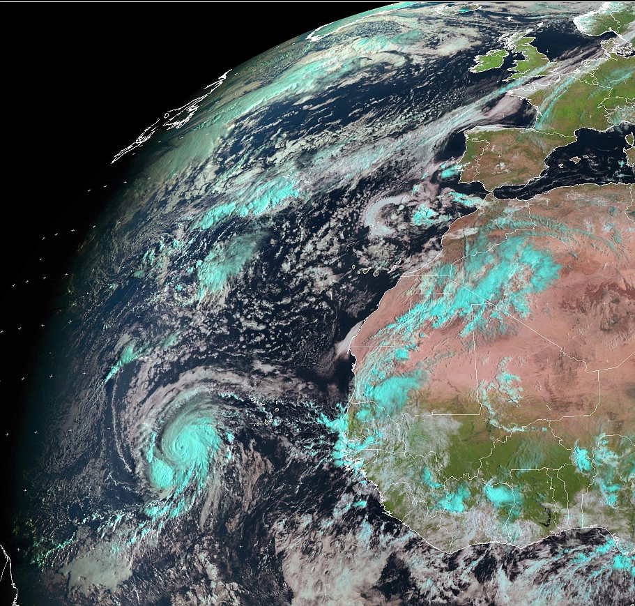
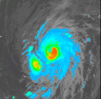
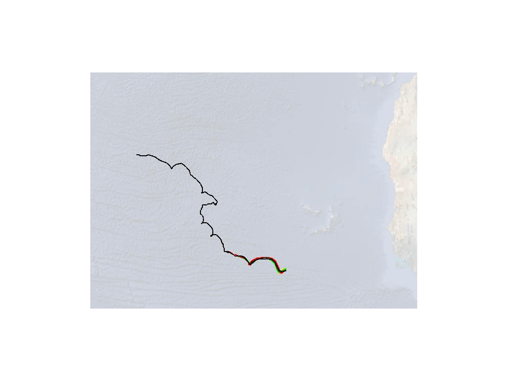
Der Klumpen ( Invest 96L ) über Gambia will von den USA gar nichts wissen ...
Irgendwann macht er ein riesen bogen und entscheidet sich
wahrscheinlich für Europa ...
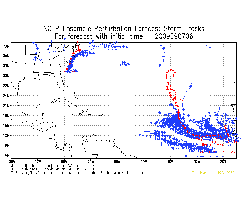
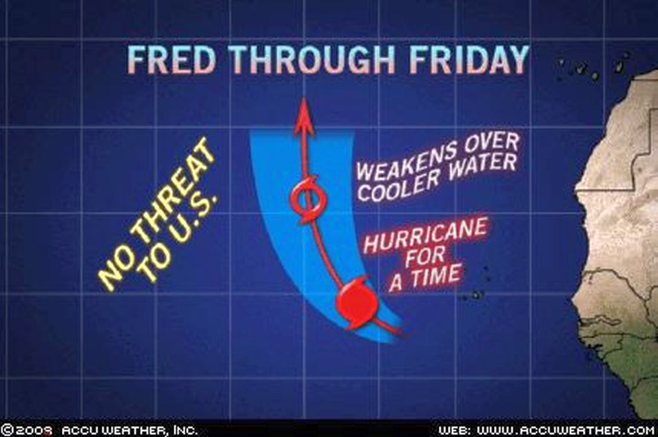
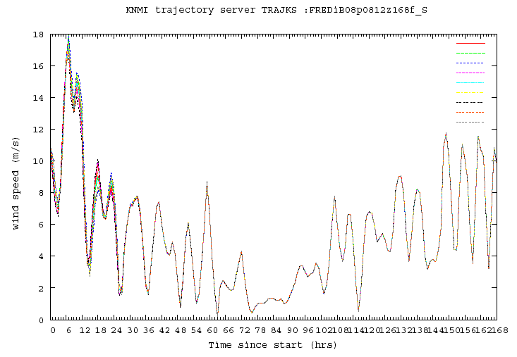
Grib ... GFS NCEP
=
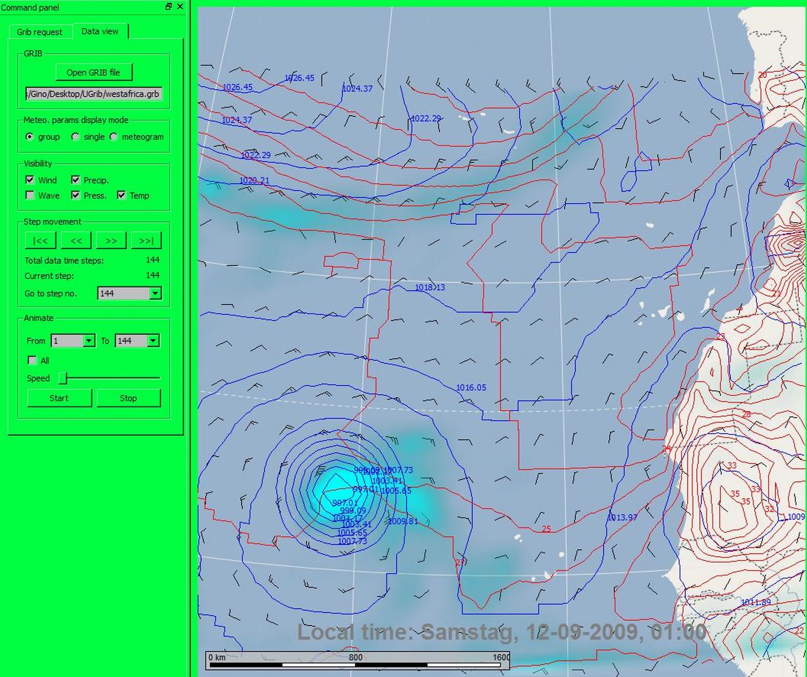
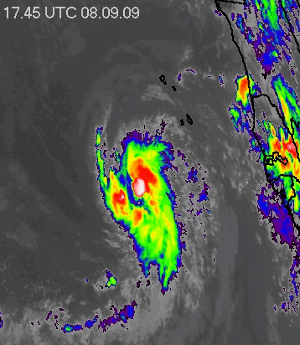
Invest 96L aktuell
=
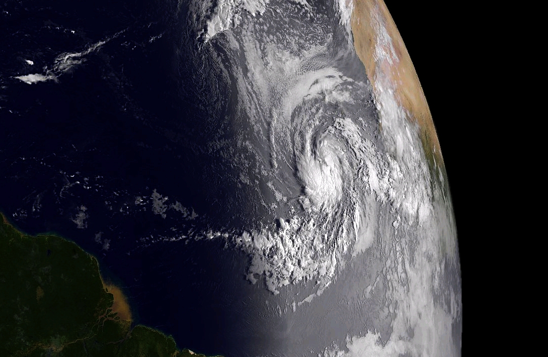
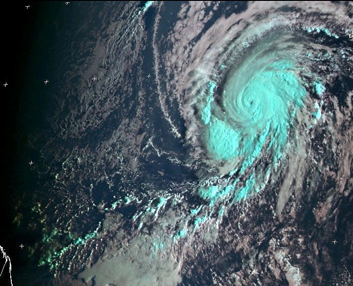
Invest 96L
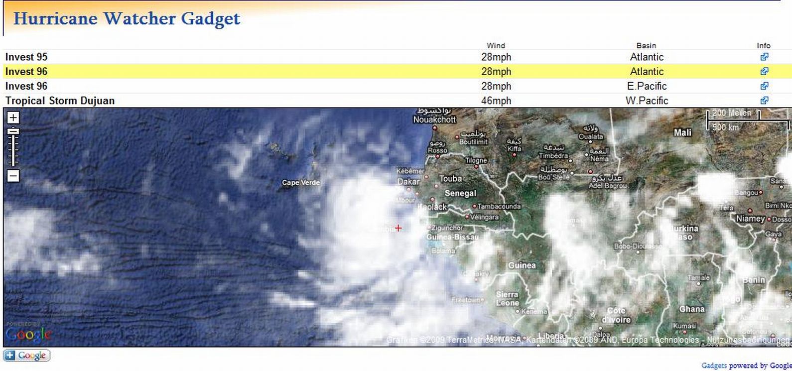
=
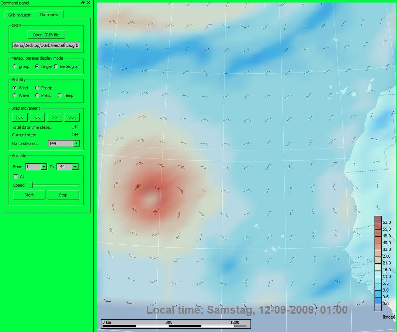
Wind Speed ... Wind Vectors at 650 hPa
http://www.sturmforum.ch/forum_uploads/ ... Gino57.jpg
=
Wind Speed ... Wind Vectors at 900 hPa
http://www.sturmforum.ch/forum_uploads/ ... Gino57.jpg