@Andreas:
da geht allerdings die Post ab, leider heute noch keine
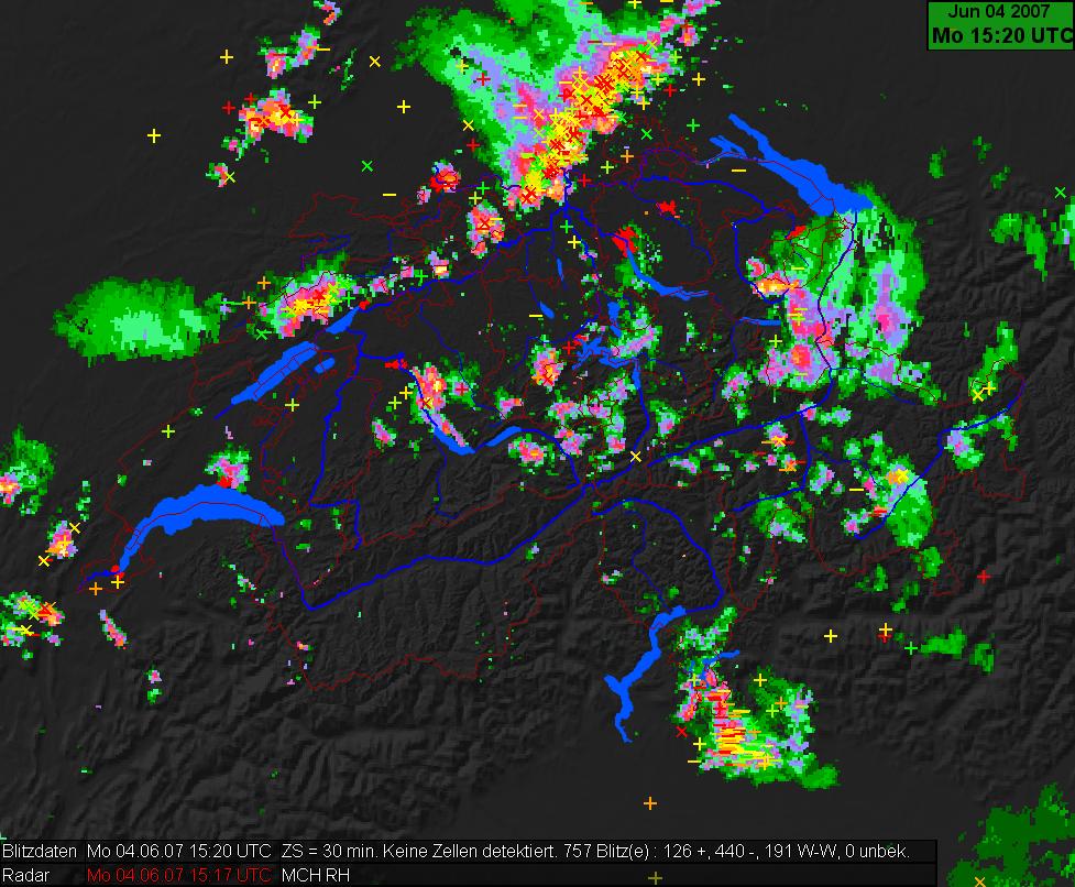
COPS IOP am laufen

waere schon der erste interessante Datensatz zum sammeln ... ja nu, es kommen ja noch mehr diese Woche, erste
Messkampagnen starten Morgen!
Gruss Marco
EDIT: hier der outlook der Kollegen, die jetzt in Baden-Baden die Missionsplanung unterstuetzen
Synoptic overview
Upper flow pattern remains largely unchanged across Europe, featuring a split-flow block pattern, leaving
Europe in essentially quiescent conditions. A few quasi-stationary small upper cut-off cyclones are
simulated by the GFS to linger over Europe, but these are not anticipated to have much effect on the
weather given minimal vorticity and temperature advection with these features. Some uncertainty exists with
respect to the development of a mesoscale surface low over central France into Germany on Thursday
evening, which is advertised by the latest GFS run. ECMWF does not support this solution at the moment,
though it does produce much convective precip, which may be indicative of increase low-level covergence.
The surface pattern is dominated by a surface high centered over the Norwegian Sea, which is forecast to
weaken in the course of the next days. Weak, slightly cyclonic surface flow should persist over much of
central Europe and the Mediterranean regions.
Analysis and forecast synoptic controls in the COPS region
The COPS area remains under the influence of moderately moist, weakly unstable and weakly capped air.
Large-scale forcing for ascent is missing, so any convective evolution will likely be tied to orography, and
maybe to mesoscale boundaries, which have not been analyzed at the moment, however.
Today’s 00Z ascents from Stuttgart and Nancy revealed an inversion near 650 hPa, which may be obstrutive
to the development of deep moist convection. Current thinking is that the majority of the cumuli will spread
beneath this stable layer, with only few parcels being able to penetrate the inversion. Though weak
buoyancy will likely be present above the inversion, it is possible that sustained updrafts will not be able to
develop. Most likely mode should be short-lived cells, though an isolated, poorly organized, small
multicellular storm could develop.
This situation will likely not change much through Tuesday and Wednesday. On Thursday evening, weak
cyclogenesis is simulated by the GFS from France into Germany, which may aid in sustenance of convection
into the late evening/night, and may also result in an increased storm coverage compared to previous days.
- Editiert von Marco (Stettfurt) am 04.06.2007, 17:40 -